Desa Baregbeg geodata
Desa Baregbeg (West Java) is a seat of a fourth-order administrative division; located in Indonesia in Asia/Jakarta (GMT+7) time zone. In our database, there are 407 cities with bigger population. Compared to other cities in Indonesia, 51% of cities are located further ↓South; 73.6% of cities are located further →East and 63.3% of cities have lower elevation than Desa Baregbeg. Note1


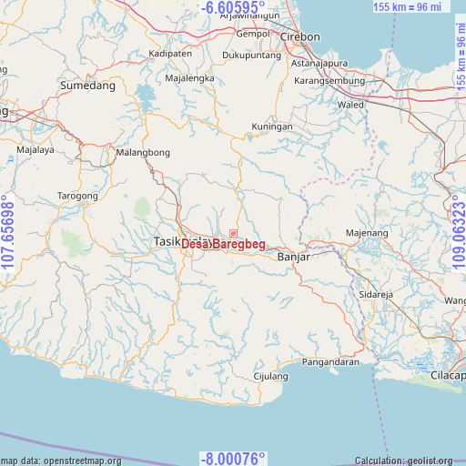
Desa Baregbeg GPS coordinates[2]
7° 18' 14.04" South, 108° 21' 36.36" East
| Map corner | latitude | longitude |
|---|---|---|
| Upper-left | -6.60595°, | 107.65698° |
| Center: | -7.3039°, | 108.3601° |
| Lower-right: | -8.00076°, | 109.06323° |
| Map W x H: | 155.1×155.1 km | = 96.4×96.4mi |
| max Lat: | 5.88969° ⇑49% North |
| Desa Baregbeg: | -7.3039° |
| min Lat: | ⇓51% South -10.934° |
| min Long | Desa Baregbeg | max Long |
| 95.1345° | 108.3601° | 140.9419° |
| W 26.4%⇐ | ⇒73.6% E |
Elevation
Elevation of Desa Baregbeg is 200 m = 656 ft, and this is 29.7 m = 97 ft below average elevation for this country.
| Max E: |
3185 m = 10449 ft | 36.7% |
| Avg. | 229.7 m = 754 ft | |
| Desa Baregbeg | 200 m = 656 ft | |
Min E: |
-1 m = -3 ft | 63.3% |
See also: Indonesia elevation on elevation.city.
Geographical zone
Desa Baregbeg is located in South Torrid zone (between Equator and Tropic of Capricorn). Distance of Equator is 812.1 km =504.6 mi to North.| Distance of | km | miles | from Desa Baregbeg |
|---|---|---|---|
| Equator | 812.1 | 504.6 | to North |
| Tropic Capricorn | 1793.8 | 1114.6 | to South |
| Antarctic Circle | 6589.1 | 4094.3 | to South |
| South Pole | 9194.9 | 5713.4 | to South |


Nearby cities:
15 places around Desa Baregbeg: (largest is in red/bold)
• Ciamis
2.5 km =1.6 mi,  196°
196°
• Cibitung
3.3 km =2.1 mi,  174°
174°
• Desa Cigembor
4.2 km =2.6 mi, 166°
• Desa Kertasari
2.7 km =1.7 mi,  158°
158°
• Desa Saguling
0.9 km =0.6 mi,  323°
323°
• Desa Sukajadi
3.4 km =2.1 mi,  260°
260°
• Desa Sukamaju
1.4 km =0.9 mi,  111°
111°
• Jelat
3.6 km =2.2 mi,  51°
51°
• Karangsari
2.5 km =1.6 mi,  215°
215°
• Kertaharja
4 km =2.5 mi,  101°
101°
• Kreteg
2.9 km =1.8 mi, 255°
• Lawong
3.2 km =2 mi,  72°
72°
• Mekarsari
1.6 km =1 mi,  268°
268°
• Rimpakgede
3.1 km =1.9 mi,  351°
351°
• Utama Wetan
3.1 km =1.9 mi,  129°
129°
Sources, notices
• [Note1] Compared only with cities in Indonesia existing in our database
• [Src1] Map data: © OpenStreetMap contributors (CC-BY-SA)
• [Src2] Other city data from geonames.org with taken over terms of usage.
• [Src3] Geographical zone / Annual Mean Temperature by Robert A. Rohde @ Wikipedia
