Gareba geodata
Gareba (West Java) is a seat of a fourth-order administrative division; located in Indonesia in Asia/Jakarta (GMT+7) time zone. In our database, there are 407 cities with bigger population. Compared to other cities in Indonesia, 55% of cities are located further ↓South; 73.4% of cities are located further →East and 74.8% of cities have lower elevation than Gareba. Note1


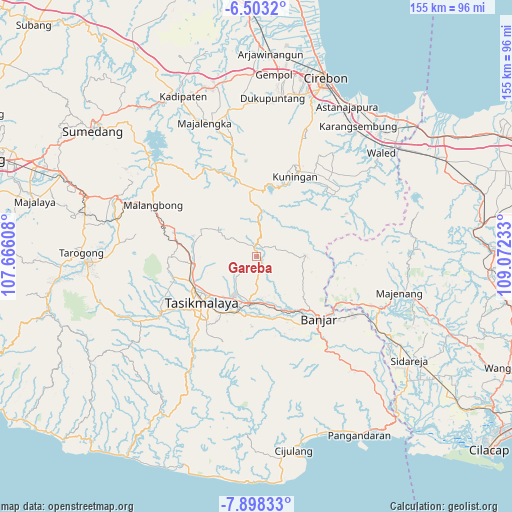
Gareba GPS coordinates[2]
7° 12' 4.68" South, 108° 22' 9.12" East
| Map corner | latitude | longitude |
|---|---|---|
| Upper-left | -6.5032°, | 107.66608° |
| Center: | -7.2013°, | 108.3692° |
| Lower-right: | -7.89833°, | 109.07233° |
| Map W x H: | 155.1×155.1 km | = 96.4×96.4mi |
| max Lat: | 5.88969° ⇑45% North |
| Gareba: | -7.2013° |
| min Lat: | ⇓55% South -10.934° |
| min Long | Gareba | max Long |
| 95.1345° | 108.3692° | 140.9419° |
| W 26.6%⇐ | ⇒73.4% E |
Elevation
Elevation of Gareba is 357 m = 1171 ft, and this is 127.3 m = 418 ft above average elevation for this country.
| Max E: |
3185 m = 10449 ft | 25.2% |
| Gareba | 357 m 1171 ft | |
| Avg. | 229.7 m = 754 ft | |
Min E: |
-1 m = -3 ft | 74.8% |
See also: Indonesia elevation on elevation.city.
Geographical zone
Gareba is located in South Torrid zone (between Equator and Tropic of Capricorn). Distance of Equator is 800.7 km =497.5 mi to North.| Distance of | km | miles | from Gareba |
|---|---|---|---|
| Equator | 800.7 | 497.5 | to North |
| Tropic Capricorn | 1805.2 | 1121.7 | to South |
| Antarctic Circle | 6600.5 | 4101.4 | to South |
| South Pole | 9206.4 | 5720.6 | to South |


Nearby cities:
15 places around Gareba: (largest is in red/bold)
• Bangbayang Kaler
3.5 km =2.2 mi,  254°
254°
• Cieurih Satu
2.2 km =1.4 mi,  226°
226°
• Cikoneng
4 km =2.5 mi,  313°
313°
• Cilongo
2.6 km =1.6 mi,  315°
315°
• Dayeuhluhur
3.4 km =2.1 mi,  31°
31°
• Desa Wetan Ciakar
1.7 km =1.1 mi,  296°
296°
• Kampungdesa
2.2 km =1.4 mi,  255°
255°
• Kawali
1.8 km =1.1 mi,  4°
4°
• Kawalimukti
2.2 km =1.4 mi,  348°
348°
• Kedawung
3.3 km =2.1 mi,  165°
165°
• Kertanagara
3 km =1.9 mi, 299°
• Kiaralawang
0.9 km =0.6 mi,  40°
40°
• Selacai
2.2 km =1.4 mi,  136°
136°
• Urug Hilir
3.9 km =2.4 mi,  188°
188°
• Winduraja
2.7 km =1.7 mi, 347°
Sources, notices
• [Note1] Compared only with cities in Indonesia existing in our database
• [Src1] Map data: © OpenStreetMap contributors (CC-BY-SA)
• [Src2] Other city data from geonames.org with taken over terms of usage.
• [Src3] Geographical zone / Annual Mean Temperature by Robert A. Rohde @ Wikipedia
