Ciguha geodata
Ciguha (West Java) is a seat of a fourth-order administrative division; located in Indonesia in Asia/Jakarta (GMT+7) time zone. In our database, there are 407 cities with bigger population. Compared to other cities in Indonesia, 58.1% of cities are located further ↑North; 72.8% of cities are located further →East and 64.6% of cities have lower elevation than Ciguha. Note1


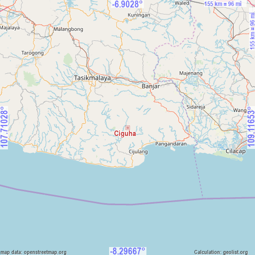
Ciguha GPS coordinates[2]
7° 36' 1.08" South, 108° 24' 48.24" East
| Map corner | latitude | longitude |
|---|---|---|
| Upper-left | -6.9028°, | 107.71028° |
| Center: | -7.6003°, | 108.4134° |
| Lower-right: | -8.29667°, | 109.11653° |
| Map W x H: | 155×155 km | = 96.3×96.3mi |
| max Lat: | 5.88969° ⇑58.1% North |
| Ciguha: | -7.6003° |
| min Lat: | ⇓41.9% South -10.934° |
| min Long | Ciguha | max Long |
| 95.1345° | 108.4134° | 140.9419° |
| W 27.2%⇐ | ⇒72.8% E |
Elevation
Elevation of Ciguha is 217 m = 712 ft, and this is 12.7 m = 42 ft below average elevation for this country.
| Max E: |
3185 m = 10449 ft | 35.4% |
| Avg. | 229.7 m = 754 ft | |
| Ciguha | 217 m = 712 ft | |
Min E: |
-1 m = -3 ft | 64.6% |
See also: Indonesia elevation on elevation.city.
Geographical zone
Ciguha is located in South Torrid zone (between Equator and Tropic of Capricorn). Distance of Equator is 845.1 km =525.1 mi to North.| Distance of | km | miles | from Ciguha |
|---|---|---|---|
| Equator | 845.1 | 525.1 | to North |
| Tropic Capricorn | 1760.8 | 1094.1 | to South |
| Antarctic Circle | 6556.1 | 4073.8 | to South |
| South Pole | 9162 | 5693 | to South |


Nearby cities:
15 places around Ciguha: (largest is in red/bold)
• Bangunsari
8.6 km =5.3 mi,  27°
27°
• Cibiru
5.3 km =3.3 mi,  153°
153°
• Cicurug
6.7 km =4.2 mi,  174°
174°
• Cigugur
3.9 km =2.4 mi, 168°
• Cikuya
5.3 km =3.3 mi,  233°
233°
• Cintajaya
8.3 km =5.2 mi,  22°
22°
• Cisagu
6.8 km =4.2 mi,  75°
75°
• Girikarya
8.3 km =5.2 mi,  337°
337°
• Jajawai
8 km =5 mi,  63°
63°
• Jayasari
9.9 km =6.2 mi,  314°
314°
• Palumbungan
3.6 km =2.2 mi,  176°
176°
• Parakan
8.8 km =5.5 mi,  132°
132°
• Pegadungan
4.7 km =2.9 mi,  279°
279°
• Sempur
8.6 km =5.3 mi,  254°
254°
• Sinagar
10.2 km =6.3 mi, 284°
Sources, notices
• [Note1] Compared only with cities in Indonesia existing in our database
• [Src1] Map data: © OpenStreetMap contributors (CC-BY-SA)
• [Src2] Other city data from geonames.org with taken over terms of usage.
• [Src3] Geographical zone / Annual Mean Temperature by Robert A. Rohde @ Wikipedia
