Wungwung geodata
Wungwung (Central Java) is a seat of a fourth-order administrative division; located in Indonesia in Asia/Jakarta (GMT+7) time zone. In our database, there are 407 cities with bigger population. Compared to other cities in Indonesia, 76.4% of cities are located further ↓South; 62.5% of cities are located further →East and 63.2% of cities have higher elevation than Wungwung. Note1


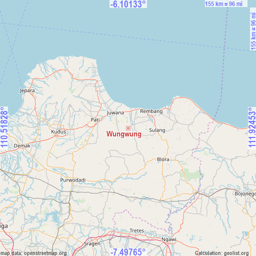
Wungwung GPS coordinates[2]
6° 48' 0" South, 111° 13' 17.04" East
| Map corner | latitude | longitude |
|---|---|---|
| Upper-left | -6.10133°, | 110.51828° |
| Center: | -6.8°, | 111.2214° |
| Lower-right: | -7.49765°, | 111.92453° |
| Map W x H: | 155.3×155.3 km | = 96.5×96.5mi |
| max Lat: | 5.88969° ⇑23.6% North |
| Wungwung: | -6.8° |
| min Lat: | ⇓76.4% South -10.934° |
| min Long | Wungwung | max Long |
| 95.1345° | 111.2214° | 140.9419° |
| W 37.5%⇐ | ⇒62.5% E |
Elevation
Elevation of Wungwung is 48 m = 157 ft, and this is 181.7 m = 596 ft below average elevation for this country.
| Max E: |
3185 m = 10449 ft | 63.2% |
| Avg. | 229.7 m = 754 ft | |
| Wungwung | 48 m = 157 ft | |
Min E: |
-1 m = -3 ft | 36.8% |
See also: Indonesia elevation on elevation.city.
Geographical zone
Wungwung is located in South Torrid zone (between Equator and Tropic of Capricorn). Distance of Equator is 756.1 km =469.8 mi to North.| Distance of | km | miles | from Wungwung |
|---|---|---|---|
| Equator | 756.1 | 469.8 | to North |
| Tropic Capricorn | 1849.8 | 1149.4 | to South |
| Antarctic Circle | 6645.1 | 4129.1 | to South |
| South Pole | 9251 | 5748.3 | to South |


Nearby cities:
15 places around Wungwung: (largest is in red/bold)
• Barisan
2.4 km =1.5 mi,  88°
88°
• Boto
3.1 km =1.9 mi,  249°
249°
• Doyok
3.4 km =2.1 mi,  65°
65°
• Gendolo
2.8 km =1.7 mi,  270°
270°
• Jaken
3.2 km =2 mi,  47°
47°
• Kemangi
3.5 km =2.2 mi,  301°
301°
• Manjang Kidul
3.6 km =2.2 mi,  40°
40°
• Mantingan
1.4 km =0.9 mi,  140°
140°
• Mantup
2.8 km =1.7 mi,  100°
100°
• Mojolampir
1.4 km =0.9 mi, 271°
• Ngulakan
2.7 km =1.7 mi,  8°
8°
• Sobo
3.7 km =2.3 mi,  348°
348°
• Sumberan
2.2 km =1.4 mi, 295°
• Taunan
2.8 km =1.7 mi, 347°
• Terteg
2.3 km =1.4 mi,  189°
189°
Sources, notices
• [Note1] Compared only with cities in Indonesia existing in our database
• [Src1] Map data: © OpenStreetMap contributors (CC-BY-SA)
• [Src2] Other city data from geonames.org with taken over terms of usage.
• [Src3] Geographical zone / Annual Mean Temperature by Robert A. Rohde @ Wikipedia
