Balegede geodata
Balegede (West Java) is a seat of a fourth-order administrative division; located in Indonesia in Asia/Jakarta (GMT+7) time zone. In our database, there are 407 cities with bigger population. Compared to other cities in Indonesia, 53.4% of cities are located further ↓South; 70.8% of cities are located further →East and 71.9% of cities have lower elevation than Balegede. Note1


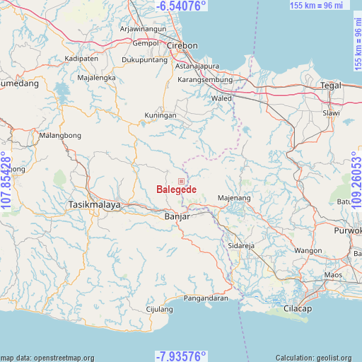
Balegede GPS coordinates[2]
7° 14' 19.68" South, 108° 33' 26.64" East
| Map corner | latitude | longitude |
|---|---|---|
| Upper-left | -6.54076°, | 107.85428° |
| Center: | -7.2388°, | 108.5574° |
| Lower-right: | -7.93576°, | 109.26053° |
| Map W x H: | 155.1×155.1 km | = 96.4×96.4mi |
| max Lat: | 5.88969° ⇑46.6% North |
| Balegede: | -7.2388° |
| min Lat: | ⇓53.4% South -10.934° |
| min Long | Balegede | max Long |
| 95.1345° | 108.5574° | 140.9419° |
| W 29.2%⇐ | ⇒70.8% E |
Elevation
Elevation of Balegede is 320 m = 1050 ft, and this is 90.3 m = 296 ft above average elevation for this country.
| Max E: |
3185 m = 10449 ft | 28.1% |
| Balegede | 320 m 1050 ft | |
| Avg. | 229.7 m = 754 ft | |
Min E: |
-1 m = -3 ft | 71.9% |
See also: Indonesia elevation on elevation.city.
Geographical zone
Balegede is located in South Torrid zone (between Equator and Tropic of Capricorn). Distance of Equator is 804.9 km =500.1 mi to North.| Distance of | km | miles | from Balegede |
|---|---|---|---|
| Equator | 804.9 | 500.1 | to North |
| Tropic Capricorn | 1801 | 1119.1 | to South |
| Antarctic Circle | 6596.3 | 4098.7 | to South |
| South Pole | 9202.2 | 5718 | to South |


Nearby cities:
15 places around Balegede: (largest is in red/bold)
• Bangunharja
6 km =3.7 mi,  186°
186°
• Cikuda
5.4 km =3.4 mi,  245°
245°
• Cimahi
5.1 km =3.2 mi,  38°
38°
• Cirateun
5.8 km =3.6 mi,  136°
136°
• Dayeuhluhur
6.3 km =3.9 mi,  111°
111°
• Harjamukti
5.2 km =3.2 mi,  293°
293°
• Kadupandak
2.5 km =1.6 mi,  18°
18°
• Kujang
6.9 km =4.3 mi,  45°
45°
• Kutaagung
6.7 km =4.2 mi,  14°
14°
• Margamulya
3.2 km =2 mi,  177°
177°
• Nangela
4.4 km =2.7 mi,  326°
326°
• Pasirmanggu
3.8 km =2.4 mi,  86°
86°
• Samarang
2.8 km =1.7 mi,  296°
296°
• Sitularang Landeuh
6.3 km =3.9 mi,  308°
308°
• Tambaksari
2.7 km =1.7 mi, 245°
Sources, notices
• [Note1] Compared only with cities in Indonesia existing in our database
• [Src1] Map data: © OpenStreetMap contributors (CC-BY-SA)
• [Src2] Other city data from geonames.org with taken over terms of usage.
• [Src3] Geographical zone / Annual Mean Temperature by Robert A. Rohde @ Wikipedia
