Buniaga geodata
Buniaga (West Java) is a seat of a fourth-order administrative division; located in Indonesia in Asia/Jakarta (GMT+7) time zone. In our database, there are 407 cities with bigger population. Compared to other cities in Indonesia, 63.8% of cities are located further ↓South; 70.4% of cities are located further →East and 55.8% of cities have lower elevation than Buniaga. Note1


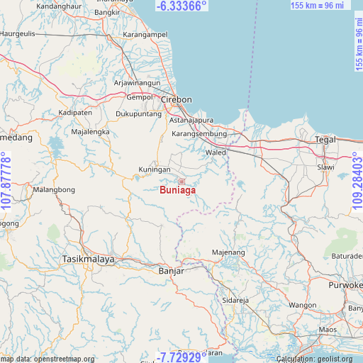
Buniaga GPS coordinates[2]
7° 1' 55.2" South, 108° 34' 51.24" East
| Map corner | latitude | longitude |
|---|---|---|
| Upper-left | -6.33366°, | 107.87778° |
| Center: | -7.032°, | 108.5809° |
| Lower-right: | -7.72929°, | 109.28403° |
| Map W x H: | 155.2×155.2 km | = 96.4×96.4mi |
| max Lat: | 5.88969° ⇑36.2% North |
| Buniaga: | -7.032° |
| min Lat: | ⇓63.8% South -10.934° |
| min Long | Buniaga | max Long |
| 95.1345° | 108.5809° | 140.9419° |
| W 29.6%⇐ | ⇒70.4% E |
Elevation
Elevation of Buniaga is 129 m = 423 ft, and this is 100.7 m = 330 ft below average elevation for this country.
| Max E: |
3185 m = 10449 ft | 44.2% |
| Avg. | 229.7 m = 754 ft | |
| Buniaga | 129 m = 423 ft | |
Min E: |
-1 m = -3 ft | 55.8% |
See also: Indonesia elevation on elevation.city.
Geographical zone
Buniaga is located in South Torrid zone (between Equator and Tropic of Capricorn). Distance of Equator is 781.9 km =485.8 mi to North.| Distance of | km | miles | from Buniaga |
|---|---|---|---|
| Equator | 781.9 | 485.8 | to North |
| Tropic Capricorn | 1824 | 1133.4 | to South |
| Antarctic Circle | 6619.3 | 4113 | to South |
| South Pole | 9225.2 | 5732.3 | to South |


Nearby cities:
15 places around Buniaga: (largest is in red/bold)
• Ciakar
2.1 km =1.3 mi,  234°
234°
• Cibuah
1.7 km =1.1 mi,  289°
289°
• Cinagara
1 km =0.6 mi,  40°
40°
• Cineumbeuy
1.5 km =0.9 mi,  53°
53°
• Cipetir
2.8 km =1.7 mi,  73°
73°
• Ciporang
2.8 km =1.7 mi,  330°
330°
• Dukuh Kaler
0.7 km =0.4 mi, 329°
• Kedatuan
1.3 km =0.8 mi,  142°
142°
• Kutamandarakan
2.6 km =1.6 mi,  280°
280°
• Kutaraja
2.5 km =1.6 mi,  298°
298°
• Langseb
1.5 km =0.9 mi,  354°
354°
• Lebakwangi
2.8 km =1.7 mi, 54°
• Mancagar
1.7 km =1.1 mi,  16°
16°
• Manis Karangtengah
0.8 km =0.5 mi, 286°
• Parakan
2.7 km =1.7 mi,  271°
271°
Sources, notices
• [Note1] Compared only with cities in Indonesia existing in our database
• [Src1] Map data: © OpenStreetMap contributors (CC-BY-SA)
• [Src2] Other city data from geonames.org with taken over terms of usage.
• [Src3] Geographical zone / Annual Mean Temperature by Robert A. Rohde @ Wikipedia
