Bonggol Satu geodata
Bonggol Satu (East Java) is a seat of a fourth-order administrative division; located in Indonesia in Asia/Jakarta (GMT+7) time zone. In our database, there are 407 cities with bigger population. Compared to other cities in Indonesia, 72.5% of cities are located further ↓South; 50.1% of cities are located further ←West and 77.1% of cities have higher elevation than Bonggol Satu. Note1


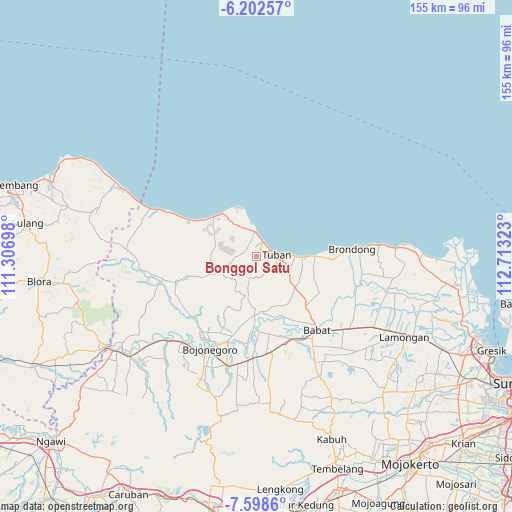
Bonggol Satu GPS coordinates[2]
6° 54' 3.96" South, 112° 0' 36.36" East
| Map corner | latitude | longitude |
|---|---|---|
| Upper-left | -6.20257°, | 111.30698° |
| Center: | -6.9011°, | 112.0101° |
| Lower-right: | -7.5986°, | 112.71323° |
| Map W x H: | 155.2×155.2 km | = 96.4×96.4mi |
| max Lat: | 5.88969° ⇑27.5% North |
| Bonggol Satu: | -6.9011° |
| min Lat: | ⇓72.5% South -10.934° |
| min Long | Bonggol Satu | max Long |
| 95.1345° | 112.0101° | 140.9419° |
| W 50.1%⇐ | ⇒49.9% E |
Elevation
Elevation of Bonggol Satu is 22 m = 72 ft, and this is 207.7 m = 681 ft below average elevation for this country.
| Max E: |
3185 m = 10449 ft | 77.1% |
| Avg. | 229.7 m = 754 ft | |
| Bonggol Satu | 22 m = 72 ft | |
Min E: |
-1 m = -3 ft | 22.9% |
See also: Indonesia elevation on elevation.city.
Geographical zone
Bonggol Satu is located in South Torrid zone (between Equator and Tropic of Capricorn). Distance of Equator is 767.3 km =476.8 mi to North.| Distance of | km | miles | from Bonggol Satu |
|---|---|---|---|
| Equator | 767.3 | 476.8 | to North |
| Tropic Capricorn | 1838.6 | 1142.5 | to South |
| Antarctic Circle | 6633.8 | 4122.1 | to South |
| South Pole | 9239.7 | 5741.3 | to South |


Nearby cities:
15 places around Bonggol Satu: (largest is in red/bold)
• Boto
1.9 km =1.2 mi,  209°
209°
• Jadikrajan
3.2 km =2 mi,  192°
192°
• Kapu
2.7 km =1.7 mi,  299°
299°
• Kembangbilo
2 km =1.2 mi,  96°
96°
• Krajan Karangsari
3.7 km =2.3 mi,  59°
59°
• Kuti
2.5 km =1.6 mi,  15°
15°
• Latsari
4.1 km =2.5 mi,  76°
76°
• Merakurak
3.7 km =2.3 mi,  313°
313°
• Merik
4.3 km =2.7 mi,  91°
91°
• Mondokan
2.4 km =1.5 mi,  43°
43°
• Pelang
2 km =1.2 mi,  288°
288°
• Sambonggede
4.1 km =2.5 mi,  315°
315°
• Sendang
2.9 km =1.8 mi,  341°
341°
• Sugiharjo
0.7 km =0.4 mi, 91°
• Taraan
0.9 km =0.6 mi,  242°
242°
Sources, notices
• [Note1] Compared only with cities in Indonesia existing in our database
• [Src1] Map data: © OpenStreetMap contributors (CC-BY-SA)
• [Src2] Other city data from geonames.org with taken over terms of usage.
• [Src3] Geographical zone / Annual Mean Temperature by Robert A. Rohde @ Wikipedia
