Kedungbanteng Krajan geodata
Kedungbanteng Krajan (East Java) is a seat of a fourth-order administrative division; located in Indonesia in Asia/Jakarta (GMT+7) time zone. In our database, there are 407 cities with bigger population. Compared to other cities in Indonesia, 79.3% of cities are located further ↑North; 57% of cities are located further ←West and 68.5% of cities have lower elevation than Kedungbanteng Krajan. Note1


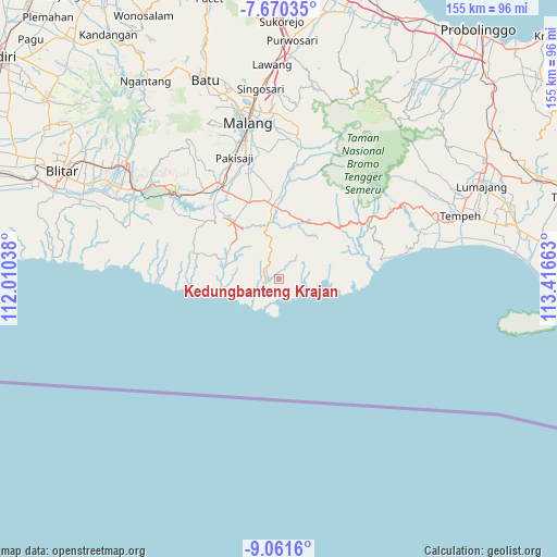
Kedungbanteng Krajan GPS coordinates[2]
8° 21' 59.76" South, 112° 42' 48.6" East
| Map corner | latitude | longitude |
|---|---|---|
| Upper-left | -7.67035°, | 112.01038° |
| Center: | -8.3666°, | 112.7135° |
| Lower-right: | -9.0616°, | 113.41663° |
| Map W x H: | 154.7×154.7 km | = 96.1×96.1mi |
| max Lat: | 5.88969° ⇑79.3% North |
| Kedungbanteng Krajan: | -8.3666° |
| min Lat: | ⇓20.7% South -10.934° |
| min Long | Kedungbanteng K | max Long |
| 95.1345° | 112.7135° | 140.9419° |
| W 57%⇐ | ⇒43% E |
Elevation
Elevation of Kedungbanteng Krajan is 272 m = 892 ft, and this is 42.3 m = 139 ft above average elevation for this country.
| Max E: |
3185 m = 10449 ft | 31.5% |
| Kedungbanteng Krajan | 272 m 892 ft | |
| Avg. | 229.7 m = 754 ft | |
Min E: |
-1 m = -3 ft | 68.5% |
See also: Indonesia elevation on elevation.city.
Geographical zone
Kedungbanteng Krajan is located in South Torrid zone (between Equator and Tropic of Capricorn). Distance of Equator is 930.3 km =578.1 mi to North.| Distance of | km | miles | from Kedungbanteng Krajan |
|---|---|---|---|
| Equator | 930.3 | 578.1 | to North |
| Tropic Capricorn | 1675.6 | 1041.2 | to South |
| Antarctic Circle | 6470.9 | 4020.8 | to South |
| South Pole | 9076.8 | 5640.1 | to South |


Nearby cities:
15 places around Kedungbanteng Krajan: (largest is in red/bold)
• Argotirto Krajan
9.1 km =5.7 mi,  342°
342°
• Donorejo
10 km =6.2 mi,  18°
18°
• Gajahrejo Krajan
7.6 km =4.7 mi,  291°
291°
• Gedangan
10.5 km =6.5 mi,  319°
319°
• Klepu Krajan
11.8 km =7.3 mi,  10°
10°
• Krajan Harjokuncaran
11.5 km =7.1 mi,  354°
354°
• Krajan Sidodadi
6.1 km =3.8 mi,  266°
266°
• Krajan Tambakrejo
4 km =2.5 mi,  178°
178°
• Ringin Kembar
10 km =6.2 mi, 8°
• Ringinsari Krajan
10.8 km =6.7 mi, 337°
• Sawur Tengah
10.4 km =6.5 mi,  46°
46°
• Sidomulyo Kulon
3.7 km =2.3 mi,  62°
62°
• Sitiarjo
3.8 km =2.4 mi,  248°
248°
• Sumbergesing Wetan
9.6 km =6 mi, 322°
• Sumbermanjing Wetan
9.9 km =6.2 mi, 344°
Sources, notices
• [Note1] Compared only with cities in Indonesia existing in our database
• [Src1] Map data: © OpenStreetMap contributors (CC-BY-SA)
• [Src2] Other city data from geonames.org with taken over terms of usage.
• [Src3] Geographical zone / Annual Mean Temperature by Robert A. Rohde @ Wikipedia
