Purwodadi Lor geodata
Purwodadi Lor (East Java) is a seat of a fourth-order administrative division; located in Indonesia in Asia/Jakarta (GMT+7) time zone. In our database, there are 407 cities with bigger population. Compared to other cities in Indonesia, 78.9% of cities are located further ↑North; 58.1% of cities are located further ←West and 66.8% of cities have higher elevation than Purwodadi Lor. Note1


Purwodadi Lor GPS coordinates[2]
8° 21' 12.96" South, 112° 50' 42.72" East
| Map corner | latitude | longitude |
|---|---|---|
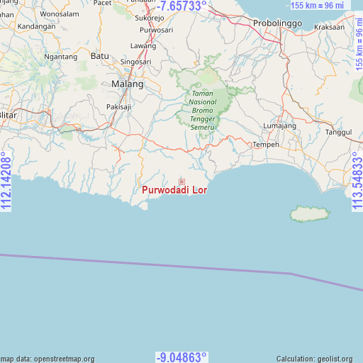
| Upper-left | -7.65733°, | 112.14208° |
| Center: | -8.3536°, | 112.8452° |
| Lower-right: | -9.04863°, | 113.54833° |
| Map W x H: | 154.7×154.7 km | = 96.1×96.1mi |
| max Lat: | 5.88969° ⇑78.9% North |
| Purwodadi Lor: | -8.3536° |
| min Lat: | ⇓21.1% South -10.934° |
| min Long | Purwodadi Lor | max Long |
| 95.1345° | 112.8452° | 140.9419° |
| W 58.1%⇐ | ⇒41.9% E |
Elevation
Elevation of Purwodadi Lor is 38 m = 125 ft, and this is 191.7 m = 629 ft below average elevation for this country.
| Max E: |
3185 m = 10449 ft | 66.8% |
| Avg. | 229.7 m = 754 ft | |
| Purwodadi Lor | 38 m = 125 ft | |
Min E: |
-1 m = -3 ft | 33.2% |
See also: Indonesia elevation on elevation.city.
Geographical zone
Purwodadi Lor is located in South Torrid zone (between Equator and Tropic of Capricorn). Distance of Equator is 928.8 km =577.1 mi to North.| Distance of | km | miles | from Purwodadi Lor |
|---|---|---|---|
| Equator | 928.8 | 577.1 | to North |
| Tropic Capricorn | 1677.1 | 1042.1 | to South |
| Antarctic Circle | 6472.3 | 4021.7 | to South |
| South Pole | 9078.2 | 5640.9 | to South |


Nearby cities:
15 places around Purwodadi Lor: (largest is in red/bold)
• Boncis
10.4 km =6.5 mi,  15°
15°
• Gampingan
5.1 km =3.2 mi,  2°
2°
• Krajan Satu B Lebakharjo
8.6 km =5.3 mi,  47°
47°
• Panggungsari
10.3 km =6.4 mi,  336°
336°
• Pujiharjo
4.4 km =2.7 mi,  110°
110°
• Purorejo
12.5 km =7.8 mi,  63°
63°
• Sawur Tengah
9.1 km =5.7 mi,  309°
309°
• Sidomulyo Kulon
11.2 km =7 mi,  271°
271°
• Sumberarum
12.2 km =7.6 mi,  322°
322°
• Sumberbuncis
10.1 km =6.3 mi, 23°
• Sumbermanggis
11.1 km =6.9 mi,  355°
355°
• Sumbersarikrajan
6 km =3.7 mi, 355°
• Tegalrejo
12 km =7.5 mi,  77°
77°
• Tirtoyudo
12.5 km =7.8 mi,  345°
345°
• Wirotaman
11.2 km =7 mi, 3°
Sources, notices
• [Note1] Compared only with cities in Indonesia existing in our database
• [Src1] Map data: © OpenStreetMap contributors (CC-BY-SA)
• [Src2] Other city data from geonames.org with taken over terms of usage.
• [Src3] Geographical zone / Annual Mean Temperature by Robert A. Rohde @ Wikipedia
