Pakpak geodata
Pakpak (East Java) is a seat of a fourth-order administrative division; located in Indonesia in Asia/Jakarta (GMT+7) time zone. In our database, there are 407 cities with bigger population. Compared to other cities in Indonesia, 71.8% of cities are located further ↓South; 59% of cities are located further ←West and 78.1% of cities have higher elevation than Pakpak. Note1


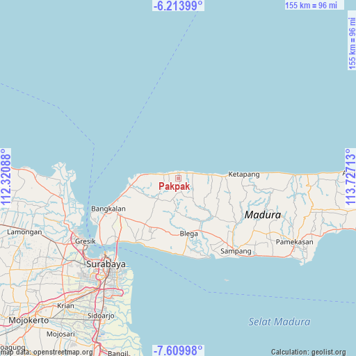
Pakpak GPS coordinates[2]
6° 54' 45" South, 113° 1' 26.4" East
| Map corner | latitude | longitude |
|---|---|---|
| Upper-left | -6.21399°, | 112.32088° |
| Center: | -6.9125°, | 113.024° |
| Lower-right: | -7.60998°, | 113.72713° |
| Map W x H: | 155.2×155.2 km | = 96.4×96.4mi |
| max Lat: | 5.88969° ⇑28.2% North |
| Pakpak: | -6.9125° |
| min Lat: | ⇓71.8% South -10.934° |
| min Long | Pakpak | max Long |
| 95.1345° | 113.024° | 140.9419° |
| W 59%⇐ | ⇒41% E |
Elevation
Elevation of Pakpak is 21 m = 69 ft, and this is 208.7 m = 685 ft below average elevation for this country.
| Max E: |
3185 m = 10449 ft | 78.1% |
| Avg. | 229.7 m = 754 ft | |
| Pakpak | 21 m = 69 ft | |
Min E: |
-1 m = -3 ft | 21.9% |
See also: Indonesia elevation on elevation.city.
Geographical zone
Pakpak is located in South Torrid zone (between Equator and Tropic of Capricorn). Distance of Equator is 768.6 km =477.6 mi to North.| Distance of | km | miles | from Pakpak |
|---|---|---|---|
| Equator | 768.6 | 477.6 | to North |
| Tropic Capricorn | 1837.3 | 1141.6 | to South |
| Antarctic Circle | 6632.6 | 4121.3 | to South |
| South Pole | 9238.5 | 5740.5 | to South |


Nearby cities:
15 places around Pakpak: (largest is in red/bold)
• Baratleke
5.2 km =3.2 mi,  216°
216°
• Dangkah
4.5 km =2.8 mi,  83°
83°
• Jeratmaling
3.5 km =2.2 mi,  299°
299°
• Kokop
3.4 km =2.1 mi,  168°
168°
• Korogan Timur
2.2 km =1.4 mi, 167°
• Marlabeng
4.9 km =3 mi,  294°
294°
• Masaran
4.9 km =3 mi, 304°
• Masjid
1.1 km =0.7 mi,  138°
138°
• Pangalangan
4.8 km =3 mi,  60°
60°
• Pedaringan
1.2 km =0.7 mi,  14°
14°
• Rukgaruk
5.2 km =3.2 mi,  207°
207°
• Talon
2.8 km =1.7 mi, 298°
• Tebanah
6 km =3.7 mi,  86°
86°
• Temana
3.5 km =2.2 mi,  42°
42°
• Timur
3 km =1.9 mi, 9°
Sources, notices
• [Note1] Compared only with cities in Indonesia existing in our database
• [Src1] Map data: © OpenStreetMap contributors (CC-BY-SA)
• [Src2] Other city data from geonames.org with taken over terms of usage.
• [Src3] Geographical zone / Annual Mean Temperature by Robert A. Rohde @ Wikipedia
