Airsagu geodata
Airsagu (East Nusa Tenggara) is a seat of a fourth-order administrative division; located in Indonesia in Asia/Makassar (GMT+8) time zone. In our database, there are 407 cities with bigger population. Compared to other cities in Indonesia, 98.1% of cities are located further ↑North; 92.8% of cities are located further ←West and 58.9% of cities have lower elevation than Airsagu. Note1


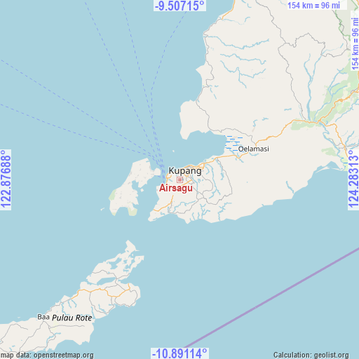
Airsagu GPS coordinates[2]
10° 11' 59.64" South, 123° 34' 48" East
| Map corner | latitude | longitude |
|---|---|---|
| Upper-left | -9.50715°, | 122.87688° |
| Center: | -10.1999°, | 123.58° |
| Lower-right: | -10.89114°, | 124.28313° |
| Map W x H: | 153.9×153.9 km | = 95.6×95.6mi |
| max Lat: | 5.88969° ⇑98.1% North |
| Airsagu: | -10.1999° |
| min Lat: | ⇓1.9% South -10.934° |
| min Long | Airsagu | max Long |
| 95.1345° | 123.58° | 140.9419° |
| W 92.8%⇐ | ⇒7.2% E |
Elevation
Elevation of Airsagu is 153 m = 502 ft, and this is 76.7 m = 252 ft below average elevation for this country.
| Max E: |
3185 m = 10449 ft | 41.1% |
| Avg. | 229.7 m = 754 ft | |
| Airsagu | 153 m = 502 ft | |
Min E: |
-1 m = -3 ft | 58.9% |
See also: Indonesia elevation on elevation.city.
Geographical zone
Airsagu is located in South Torrid zone (between Equator and Tropic of Capricorn). Distance of Equator is 1134.1 km =704.7 mi to North.| Distance of | km | miles | from Airsagu |
|---|---|---|---|
| Equator | 1134.1 | 704.7 | to North |
| Tropic Capricorn | 1471.8 | 914.5 | to South |
| Antarctic Circle | 6267.1 | 3894.2 | to South |
| South Pole | 8872.9 | 5513.4 | to South |


Nearby cities:
15 places around Airsagu: (largest is in red/bold)
• Airmata
3.7 km =2.3 mi,  356°
356°
• Airnona
2.1 km =1.3 mi,  14°
14°
• Bakunase
1.7 km =1.1 mi,  24°
24°
• Bonik
2.8 km =1.7 mi,  93°
93°
• Fontein
3.8 km =2.4 mi,  3°
3°
• Kuanino
3.4 km =2.1 mi, 18°
• Mantasi
3 km =1.9 mi, 0°
• Manutapen
2.6 km =1.6 mi,  351°
351°
• Naikoten Dua
3.6 km =2.2 mi,  33°
33°
• Namosain
3.8 km =2.4 mi,  321°
321°
• Nunbaundelha
3.3 km =2.1 mi,  340°
340°
• Nunbaunsabu
3.4 km =2.1 mi,  333°
333°
• Nunhila
3.7 km =2.3 mi, 345°
• Oepura
3.3 km =2.1 mi,  68°
68°
• Tabun
2 km =1.2 mi,  195°
195°
Sources, notices
• [Note1] Compared only with cities in Indonesia existing in our database
• [Src1] Map data: © OpenStreetMap contributors (CC-BY-SA)
• [Src2] Other city data from geonames.org with taken over terms of usage.
• [Src3] Geographical zone / Annual Mean Temperature by Robert A. Rohde @ Wikipedia
