Duko Tengah geodata
Duko Tengah (East Java) is a seat of a fourth-order administrative division; located in Indonesia in Asia/Jakarta (GMT+7) time zone. In our database, there are 407 cities with bigger population. Compared to other cities in Indonesia, 74.8% of cities are located further ↓South; 73.4% of cities are located further ←West and 71.2% of cities have higher elevation than Duko Tengah. Note1


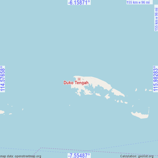
Duko Tengah GPS coordinates[2]
6° 51' 26.28" South, 115° 16' 46.92" East
| Map corner | latitude | longitude |
|---|---|---|
| Upper-left | -6.15871°, | 114.57658° |
| Center: | -6.8573°, | 115.2797° |
| Lower-right: | -7.55487°, | 115.98283° |
| Map W x H: | 155.2×155.2 km | = 96.4×96.4mi |
| max Lat: | 5.88969° ⇑25.2% North |
| Duko Tengah: | -6.8573° |
| min Lat: | ⇓74.8% South -10.934° |
| min Long | Duko Tengah | max Long |
| 95.1345° | 115.2797° | 140.9419° |
| W 73.4%⇐ | ⇒26.6% E |
Elevation
Elevation of Duko Tengah is 30 m = 98 ft, and this is 199.7 m = 655 ft below average elevation for this country.
| Max E: |
3185 m = 10449 ft | 71.2% |
| Avg. | 229.7 m = 754 ft | |
| Duko Tengah | 30 m = 98 ft | |
Min E: |
-1 m = -3 ft | 28.8% |
See also: Indonesia elevation on elevation.city.
Geographical zone
Duko Tengah is located in South Torrid zone (between Equator and Tropic of Capricorn). Distance of Equator is 762.5 km =473.8 mi to North.| Distance of | km | miles | from Duko Tengah |
|---|---|---|---|
| Equator | 762.5 | 473.8 | to North |
| Tropic Capricorn | 1843.5 | 1145.5 | to South |
| Antarctic Circle | 6638.7 | 4125.1 | to South |
| South Pole | 9244.6 | 5744.3 | to South |


Nearby cities:
15 places around Duko Tengah: (largest is in red/bold)
• Anyar
1.8 km =1.1 mi,  93°
93°
• Arjasa
0.7 km =0.4 mi,  112°
112°
• Beting
3.4 km =2.1 mi, 87°
• Gerelayang
2 km =1.2 mi,  284°
284°
• Kettep
0.7 km =0.4 mi,  130°
130°
• Larangan
5.4 km =3.4 mi, 132°
• Mandar
2.8 km =1.7 mi, 276°
• Nyangkleng
1.4 km =0.9 mi,  80°
80°
• Parse
1 km =0.6 mi,  251°
251°
• Pasar
4.4 km =2.7 mi, 92°
• Pasarbaru
4.1 km =2.5 mi, 94°
• Sumbernangka Tengah
1.3 km =0.8 mi,  289°
289°
• Tampakdandang
1.8 km =1.1 mi,  259°
259°
• Timurlorong
1.8 km =1.1 mi, 252°
• Utarapasar
0.8 km =0.5 mi,  74°
74°
Sources, notices
• [Note1] Compared only with cities in Indonesia existing in our database
• [Src1] Map data: © OpenStreetMap contributors (CC-BY-SA)
• [Src2] Other city data from geonames.org with taken over terms of usage.
• [Src3] Geographical zone / Annual Mean Temperature by Robert A. Rohde @ Wikipedia
