Tanjungbahagia geodata
Tanjungbahagia (East Nusa Tenggara) is a seat of a fourth-order administrative division; located in Indonesia in Asia/Makassar (GMT+8) time zone. In our database, there are 407 cities with bigger population. Compared to other cities in Indonesia, 76.6% of cities are located further ↑North; 91.8% of cities are located further ←West and 83% of cities have higher elevation than Tanjungbahagia. Note1


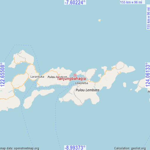
Tanjungbahagia GPS coordinates[2]
8° 17' 54.96" South, 123° 21' 29.52" East
| Map corner | latitude | longitude |
|---|---|---|
| Upper-left | -7.60224°, | 122.65508° |
| Center: | -8.2986°, | 123.3582° |
| Lower-right: | -8.99373°, | 124.06133° |
| Map W x H: | 154.7×154.7 km | = 96.1×96.1mi |
| max Lat: | 5.88969° ⇑76.6% North |
| Tanjungbahagia: | -8.2986° |
| min Lat: | ⇓23.4% South -10.934° |
| min Long | Tanjungbahagia | max Long |
| 95.1345° | 123.3582° | 140.9419° |
| W 91.8%⇐ | ⇒8.2% E |
Elevation
Elevation of Tanjungbahagia is 16 m = 52 ft, and this is 213.7 m = 701 ft below average elevation for this country.
| Max E: |
3185 m = 10449 ft | 83% |
| Avg. | 229.7 m = 754 ft | |
| Tanjungbahagia | 16 m = 52 ft | |
Min E: |
-1 m = -3 ft | 17% |
See also: Indonesia elevation on elevation.city.
Geographical zone
Tanjungbahagia is located in South Torrid zone (between Equator and Tropic of Capricorn). Distance of Equator is 922.7 km =573.3 mi to North.| Distance of | km | miles | from Tanjungbahagia |
|---|---|---|---|
| Equator | 922.7 | 573.3 | to North |
| Tropic Capricorn | 1683.2 | 1045.9 | to South |
| Antarctic Circle | 6478.5 | 4025.6 | to South |
| South Pole | 9084.3 | 5644.7 | to South |


Nearby cities:
15 places around Tanjungbahagia: (largest is in red/bold)
• Auona
10.9 km =6.8 mi,  276°
276°
• Holoriang
5.4 km =3.4 mi,  57°
57°
• Kotablolong
10.2 km =6.3 mi,  269°
269°
• Lamablawa
10.8 km =6.7 mi, 270°
• Lewobelen
4.8 km =3 mi,  54°
54°
• Lewoblolong
8.9 km =5.5 mi,  258°
258°
• Lewokemie
9.3 km =5.8 mi, 280°
• Lewoleba
10.5 km =6.5 mi,  141°
141°
• Ohe
11.1 km =6.9 mi,  98°
98°
• Pledo
10.4 km =6.5 mi, 271°
• Riangbao
10.3 km =6.4 mi,  91°
91°
• Riangderi
9.4 km =5.8 mi,  220°
220°
• Watoone
10.4 km =6.5 mi, 267°
• Werangere
10.7 km =6.6 mi, 268°
• Witihama
10.5 km =6.5 mi, 269°
Sources, notices
• [Note1] Compared only with cities in Indonesia existing in our database
• [Src1] Map data: © OpenStreetMap contributors (CC-BY-SA)
• [Src2] Other city data from geonames.org with taken over terms of usage.
• [Src3] Geographical zone / Annual Mean Temperature by Robert A. Rohde @ Wikipedia
