Wailolong geodata
Wailolong (East Nusa Tenggara) is a seat of a fourth-order administrative division; located in Indonesia in Asia/Makassar (GMT+8) time zone. In our database, there are 407 cities with bigger population. Compared to other cities in Indonesia, 77.5% of cities are located further ↑North; 89.8% of cities are located further ←West and 61.3% of cities have higher elevation than Wailolong. Note1


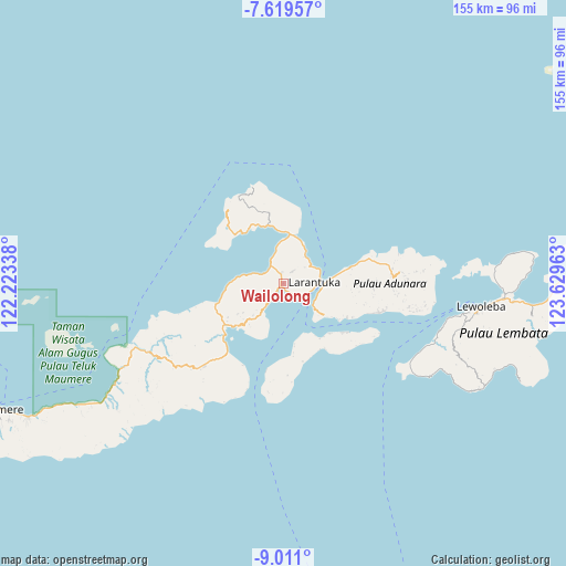
Wailolong GPS coordinates[2]
8° 18' 57.24" South, 122° 55' 35.4" East
| Map corner | latitude | longitude |
|---|---|---|
| Upper-left | -7.61957°, | 122.22338° |
| Center: | -8.3159°, | 122.9265° |
| Lower-right: | -9.011°, | 123.62963° |
| Map W x H: | 154.7×154.7 km | = 96.1×96.1mi |
| max Lat: | 5.88969° ⇑77.5% North |
| Wailolong: | -8.3159° |
| min Lat: | ⇓22.5% South -10.934° |
| min Long | Wailolong | max Long |
| 95.1345° | 122.9265° | 140.9419° |
| W 89.8%⇐ | ⇒10.2% E |
Elevation
Elevation of Wailolong is 54 m = 177 ft, and this is 175.7 m = 576 ft below average elevation for this country.
| Max E: |
3185 m = 10449 ft | 61.3% |
| Avg. | 229.7 m = 754 ft | |
| Wailolong | 54 m = 177 ft | |
Min E: |
-1 m = -3 ft | 38.7% |
See also: Indonesia elevation on elevation.city.
Geographical zone
Wailolong is located in South Torrid zone (between Equator and Tropic of Capricorn). Distance of Equator is 924.6 km =574.5 mi to North.| Distance of | km | miles | from Wailolong |
|---|---|---|---|
| Equator | 924.6 | 574.5 | to North |
| Tropic Capricorn | 1681.3 | 1044.7 | to South |
| Antarctic Circle | 6476.5 | 4024.3 | to South |
| South Pole | 9082.4 | 5643.5 | to South |


Nearby cities:
15 places around Wailolong: (largest is in red/bold)
• Balela
6.8 km =4.2 mi,  118°
118°
• Kawaliwu
5.9 km =3.7 mi,  325°
325°
• Lamatou
3.2 km =2 mi,  0°
0°
• Lamawalang
2 km =1.2 mi,  159°
159°
• Larantuka
6.5 km =4 mi, 121°
• Lewohala
4.7 km =2.9 mi,  39°
39°
• Lewolere
5.1 km =3.2 mi,  134°
134°
• Lewoloba
1 km =0.6 mi,  153°
153°
• Lewotola
2.8 km =1.7 mi,  343°
343°
• Pantaibesar
5.9 km =3.7 mi, 128°
• Pohonsirih
6.9 km =4.3 mi, 116°
• Raganama
3.1 km =1.9 mi,  221°
221°
• Riangpedang
5.9 km =3.7 mi,  298°
298°
• Waibalun
4.5 km =2.8 mi,  137°
137°
• Watotenga
3.9 km =2.4 mi, 35°
Sources, notices
• [Note1] Compared only with cities in Indonesia existing in our database
• [Src1] Map data: © OpenStreetMap contributors (CC-BY-SA)
• [Src2] Other city data from geonames.org with taken over terms of usage.
• [Src3] Geographical zone / Annual Mean Temperature by Robert A. Rohde @ Wikipedia
