Kampung Jawa geodata
Kampung Jawa (Riau) is a seat of a fourth-order administrative division; located in Indonesia in Asia/Jakarta (GMT+7) time zone. In our database, there are 407 cities with bigger population. Compared to other cities in Indonesia, 97.3% of cities are located further ↓South; 96.7% of cities are located further →East and 95.5% of cities have higher elevation than Kampung Jawa. Note1


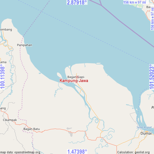
Kampung Jawa GPS coordinates[2]
2° 10' 36.264" North, 100° 49' 1.56" East
| Map corner | latitude | longitude |
|---|---|---|
| Upper-left | 2.87918°, | 100.11398° |
| Center: | 2.17674°, | 100.8171° |
| Lower-right: | 1.47398°, | 101.52023° |
| Map W x H: | 156.2×156.2 km | = 97.1×97.1mi |
| max Lat: | 5.88969° ⇑2.7% North |
| Kampung Jawa: | 2.17674° |
| min Lat: | ⇓97.3% South -10.934° |
| min Long | Kampung Jawa | max Long |
| 95.1345° | 100.8171° | 140.9419° |
| W 3.3%⇐ | ⇒96.7% E |
Elevation
Elevation of Kampung Jawa is 7 m = 23 ft, and this is 222.7 m = 731 ft below average elevation for this country.
| Max E: |
3185 m = 10449 ft | 95.5% |
| Avg. | 229.7 m = 754 ft | |
| Kampung Jawa | 7 m = 23 ft | |
Min E: |
-1 m = -3 ft | 4.5% |
See also: Indonesia elevation on elevation.city.
Geographical zone
Kampung Jawa is located in North Torrid zone (between Equator and Tropic of Cancer). Distance of Equator is 242 km =150.4 mi to South.| Distance of | km | miles | from Kampung Jawa |
|---|---|---|---|
| North Pole | 9765 | 6067.7 | to North |
| Arctic Circle | 7159.1 | 4448.5 | to North |
| Tropic Cancer | 2363.9 | 1468.9 | to North |
| Equator | 242 | 150.4 | to South |


Nearby cities:
15 places around Kampung Jawa: (largest is in red/bold)
• Baganhilir
0.8 km =0.5 mi,  299°
299°
• Baganhulubaru
3.3 km =2.1 mi,  199°
199°
• Bagansiapiapi
2.5 km =1.6 mi,  205°
205°
• Bintang
4.5 km =2.8 mi,  184°
184°
• Labuhantanggabesar
17.8 km =11.1 mi,  153°
153°
• Paritaman
2.6 km =1.6 mi,  350°
350°
• Paritjunus
27.9 km =17.3 mi,  244°
244°
• Paritkalipatopah
25.8 km =16 mi,  227°
227°
• Pasir
4.2 km =2.6 mi,  194°
194°
• Rantaupanjangkiri
24.9 km =15.5 mi, 235°
• Serusa
4.8 km =3 mi,  2°
2°
• Simpangpasir
27.1 km =16.8 mi,  247°
247°
• Sungaimaja
25.1 km =15.6 mi, 232°
• Sungaisegajah
22.8 km =14.2 mi, 239°
• Tanjunglumbalumba
21 km =13 mi, 242°
Sources, notices
• [Note1] Compared only with cities in Indonesia existing in our database
• [Src1] Map data: © OpenStreetMap contributors (CC-BY-SA)
• [Src2] Other city data from geonames.org with taken over terms of usage.
• [Src3] Geographical zone / Annual Mean Temperature by Robert A. Rohde @ Wikipedia
