Payakumbuh geodata
Payakumbuh (West Sumatra) is a seat of a second-order administrative division; located in Indonesia in Asia/Jakarta (GMT+7) time zone. With population of 121,572 people, there are 108 cities with bigger population in this country. Compared to other cities in Indonesia, 95% of cities are located further ↓South; 96.9% of cities are located further →East and 84.9% of cities have lower elevation than Payakumbuh. Note1


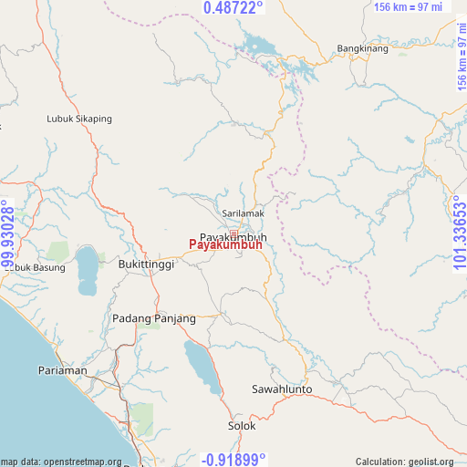
Payakumbuh GPS coordinates[2]
0° 12' 57.24" South, 100° 38' 0.24" East
| Map corner | latitude | longitude |
|---|---|---|
| Upper-left | 0.48722°, | 99.93028° |
| Center: | -0.2159°, | 100.6334° |
| Lower-right: | -0.91899°, | 101.33653° |
| Map W x H: | 156.4×156.4 km | = 97.2×97.2mi |
| max Lat: | 5.88969° ⇑5% North |
| Payakumbuh: | -0.2159° |
| min Lat: | ⇓95% South -10.934° |
| min Long | Payakumbuh | max Long |
| 95.1345° | 100.6334° | 140.9419° |
| W 3.1%⇐ | ⇒96.9% E |
Elevation
Elevation of Payakumbuh is 517 m = 1696 ft, and this is 287.3 m = 943 ft above average elevation for this country.
| Max E: |
3185 m = 10449 ft | 15.1% |
| Payakumbuh | 517 m 1696 ft | |
| Avg. | 229.7 m = 754 ft | |
Min E: |
-1 m = -3 ft | 84.9% |
See also: Payakumbuh elevation on elevation.city.
Geographical zone
Payakumbuh is located in South Torrid zone (between Equator and Tropic of Capricorn). Distance of Equator is 24 km =14.9 mi to North.| Distance of | km | miles | from Payakumbuh |
|---|---|---|---|
| Equator | 24 | 14.9 | to North |
| Tropic Capricorn | 2581.9 | 1604.3 | to South |
| Antarctic Circle | 7377.2 | 4584 | to South |
| South Pole | 9983.1 | 6203.2 | to South |


Nearby cities:
15 places around Payakumbuh: (largest is in red/bold)
• Baso
21.2 km =13.2 mi,  250°
250°
• Batusangkar
27.3 km =17 mi,  185°
185°
• Bukittinggi
31 km =19.3 mi, 250°
• Guguk
12.4 km =7.7 mi,  313°
313°
• Kotatua
33.4 km =20.8 mi,  244°
244°
• Matur
39 km =24.2 mi,  259°
259°
• Rambatan
32.2 km =20 mi,  197°
197°
• Salimpaung
17.8 km =11.1 mi,  211°
211°
• Sarilamak
8 km =5 mi,  25°
25°
• Saruaso
29.7 km =18.5 mi,  179°
179°
• Simabur
30 km =18.6 mi, 202°
• Sungayang
21.7 km =13.5 mi, 190°
• Tanjung Mas
34.9 km =21.7 mi,  153°
153°
• Tanjunggadang
15 km =9.3 mi,  129°
129°
• Tanjungpati
8.1 km =5 mi,  40°
40°
Sources, notices
• [Note1] Compared only with cities in Indonesia existing in our database
• [Src1] Map data: © OpenStreetMap contributors (CC-BY-SA)
• [Src2] Other city data from geonames.org with taken over terms of usage.
• [Src3] Geographical zone / Annual Mean Temperature by Robert A. Rohde @ Wikipedia
