Lela geodata
Lela (East Nusa Tenggara) is a seat of a third-order administrative division; located in Indonesia in Asia/Makassar (GMT+8) time zone. In our database, there are 407 cities with bigger population. Compared to other cities in Indonesia, 89.9% of cities are located further ↑North; 88.4% of cities are located further ←West and 85.2% of cities have higher elevation than Lela. Note1


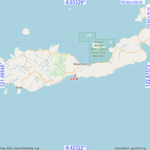
Lela GPS coordinates[2]
8° 43' 44.04" South, 122° 10' 21.36" East
| Map corner | latitude | longitude |
|---|---|---|
| Upper-left | -8.03329°, | 121.46948° |
| Center: | -8.7289°, | 122.1726° |
| Lower-right: | -9.42322°, | 122.87573° |
| Map W x H: | 154.5×154.5 km | = 96×96mi |
| max Lat: | 5.88969° ⇑89.9% North |
| Lela: | -8.7289° |
| min Lat: | ⇓10.1% South -10.934° |
| min Long | Lela | max Long |
| 95.1345° | 122.1726° | 140.9419° |
| W 88.4%⇐ | ⇒11.6% E |
Elevation
Elevation of Lela is 14 m = 46 ft, and this is 215.7 m = 708 ft below average elevation for this country.
| Max E: |
3185 m = 10449 ft | 85.2% |
| Avg. | 229.7 m = 754 ft | |
| Lela | 14 m = 46 ft | |
Min E: |
-1 m = -3 ft | 14.8% |
See also: Indonesia elevation on elevation.city.
Geographical zone
Lela is located in South Torrid zone (between Equator and Tropic of Capricorn). Distance of Equator is 970.6 km =603.1 mi to North.| Distance of | km | miles | from Lela |
|---|---|---|---|
| Equator | 970.6 | 603.1 | to North |
| Tropic Capricorn | 1635.4 | 1016.2 | to South |
| Antarctic Circle | 6430.6 | 3995.8 | to South |
| South Pole | 9036.5 | 5615 | to South |


Nearby cities:
15 places around Lela: (largest is in red/bold)
• Bloro
5.2 km =3.2 mi,  344°
344°
• Diller
4.3 km =2.7 mi,  27°
27°
• Gehaklau
4.7 km =2.9 mi,  36°
36°
• Halat
6.4 km =4 mi, 36°
• Hepang
3.2 km =2 mi,  309°
309°
• Kojagete
4.6 km =2.9 mi,  20°
20°
• Kotingnatagete
5.7 km =3.5 mi, 23°
• Nita
5.6 km =3.5 mi,  357°
357°
• Nitakloang
6.6 km =4.1 mi,  351°
351°
• Puho
2.8 km =1.7 mi,  53°
53°
• Ritapiret
6.4 km =4 mi,  1°
1°
• Sikka
3.4 km =2.1 mi,  131°
131°
• Tebuk
5.1 km =3.2 mi, 357°
• Tilang
6.3 km =3.9 mi,  299°
299°
• Watubura
4.3 km =2.7 mi,  286°
286°
Sources, notices
• [Note1] Compared only with cities in Indonesia existing in our database
• [Src1] Map data: © OpenStreetMap contributors (CC-BY-SA)
• [Src2] Other city data from geonames.org with taken over terms of usage.
• [Src3] Geographical zone / Annual Mean Temperature by Robert A. Rohde @ Wikipedia
