Klungkung geodata
Klungkung (Bali) is a populated place; located in Indonesia in Asia/Makassar (GMT+8) time zone. With population of 27,836 people, there are 331 cities with bigger population in this country. Compared to other cities in Indonesia, 84.7% of cities are located further ↑North; 74.4% of cities are located further ←West and 52% of cities have higher elevation than Klungkung. Note1


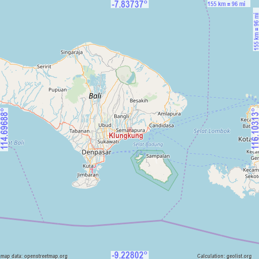
Klungkung GPS coordinates[2]
8° 31' 59.988" South, 115° 24' 0" East
| Map corner | latitude | longitude |
|---|---|---|
| Upper-left | -7.83737°, | 114.69688° |
| Center: | -8.53333°, | 115.4° |
| Lower-right: | -9.22802°, | 116.10313° |
| Map W x H: | 154.6×154.6 km | = 96.1×96.1mi |
| max Lat: | 5.88969° ⇑84.7% North |
| Klungkung: | -8.53333° |
| min Lat: | ⇓15.3% South -10.934° |
| min Long | Klungkung | max Long |
| 95.1345° | 115.4° | 140.9419° |
| W 74.4%⇐ | ⇒25.6% E |
Elevation
Elevation of Klungkung is 95 m = 312 ft, and this is 134.7 m = 442 ft below average elevation for this country.
| Max E: |
3185 m = 10449 ft | 52% |
| Avg. | 229.7 m = 754 ft | |
| Klungkung | 95 m = 312 ft | |
Min E: |
-1 m = -3 ft | 48% |
See also: Indonesia elevation on elevation.city.
Geographical zone
Klungkung is located in South Torrid zone (between Equator and Tropic of Capricorn). Distance of Equator is 948.8 km =589.6 mi to North.| Distance of | km | miles | from Klungkung |
|---|---|---|---|
| Equator | 948.8 | 589.6 | to North |
| Tropic Capricorn | 1657.1 | 1029.7 | to South |
| Antarctic Circle | 6452.4 | 4009.3 | to South |
| South Pole | 9058.2 | 5628.5 | to South |


Nearby cities:
15 places around Klungkung: (largest is in red/bold)
• Banjar Jabon
1.7 km =1.1 mi,  109°
109°
• Banjar Kaleran
2.5 km =1.6 mi,  341°
341°
• Banjar Kanginan
1.7 km =1.1 mi,  91°
91°
• Banjar Kawan
2.6 km =1.6 mi,  188°
188°
• Banjar Lebah
0.7 km =0.4 mi, 87°
• Banjar Nyamping
2.8 km =1.7 mi, 113°
• Banjar Pegatepan
2.4 km =1.5 mi,  161°
161°
• Banjar Pekandelan
0.5 km =0.3 mi, 192°
• Banjar Pekandelan
1.9 km =1.2 mi,  4°
4°
• Banjar Tihingan
1.8 km =1.1 mi,  275°
275°
• Banjar Tojan Kelod
2.5 km =1.6 mi,  175°
175°
• Banjar Ulumsul
2.2 km =1.4 mi,  120°
120°
• Banjar Umesalakan
2.8 km =1.7 mi,  216°
216°
• Semarapura
0.3 km =0.2 mi, 120°
• Tubanan
2.3 km =1.4 mi, 155°
Sources, notices
• [Note1] Compared only with cities in Indonesia existing in our database
• [Src1] Map data: © OpenStreetMap contributors (CC-BY-SA)
• [Src2] Other city data from geonames.org with taken over terms of usage.
• [Src3] Geographical zone / Annual Mean Temperature by Robert A. Rohde @ Wikipedia
