Kefamenanu geodata
Kefamenanu (East Nusa Tenggara) is a seat of a second-order administrative division; located in Indonesia in Asia/Makassar (GMT+8) time zone. With population of 29,490 people, there are 318 cities with bigger population in this country. Compared to other cities in Indonesia, 92.8% of cities are located further ↑North; 96.3% of cities are located further ←West and 78.7% of cities have lower elevation than Kefamenanu. Note1


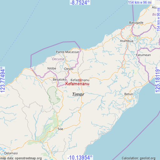
Kefamenanu GPS coordinates[2]
9° 26' 48.012" South, 124° 28' 41.016" East
| Map corner | latitude | longitude |
|---|---|---|
| Upper-left | -8.7524°, | 123.77494° |
| Center: | -9.44667°, | 124.47806° |
| Lower-right: | -10.13954°, | 125.18119° |
| Map W x H: | 154.2×154.2 km | = 95.8×95.8mi |
| max Lat: | 5.88969° ⇑92.8% North |
| Kefamenanu: | -9.44667° |
| min Lat: | ⇓7.2% South -10.934° |
| min Long | Kefamenanu | max Long |
| 95.1345° | 124.47806° | 140.9419° |
| W 96.3%⇐ | ⇒3.7% E |
Elevation
Elevation of Kefamenanu is 409 m = 1342 ft, and this is 179.3 m = 588 ft above average elevation for this country.
| Max E: |
3185 m = 10449 ft | 21.3% |
| Kefamenanu | 409 m 1342 ft | |
| Avg. | 229.7 m = 754 ft | |
Min E: |
-1 m = -3 ft | 78.7% |
See also: Indonesia elevation on elevation.city.
Geographical zone
Kefamenanu is located in South Torrid zone (between Equator and Tropic of Capricorn). Distance of Equator is 1050.4 km =652.7 mi to North.| Distance of | km | miles | from Kefamenanu |
|---|---|---|---|
| Equator | 1050.4 | 652.7 | to North |
| Tropic Capricorn | 1555.5 | 966.5 | to South |
| Antarctic Circle | 6350.8 | 3946.2 | to South |
| South Pole | 8956.7 | 5565.4 | to South |


Nearby cities:
15 places around Kefamenanu: (largest is in red/bold)
• Basan
12.1 km =7.5 mi,  251°
251°
• Bijaepasu
10.8 km =6.7 mi,  212°
212°
• Fatualam
9.5 km =5.9 mi,  129°
129°
• Fatumuti
13.5 km =8.4 mi,  176°
176°
• Kampungtengah
13.5 km =8.4 mi,  185°
185°
• Metkono
12.5 km =7.8 mi, 214°
• Muesanaik
13.8 km =8.6 mi,  240°
240°
• Naiola
11.7 km =7.3 mi,  165°
165°
• Noemuti
13.6 km =8.5 mi, 172°
• Nunpo
14 km =8.7 mi, 252°
• Nunsena
8.6 km =5.3 mi,  201°
201°
• Oebaki
15.7 km =9.8 mi,  220°
220°
• Oenak
13 km =8.1 mi, 168°
• Pakaebena
14.2 km =8.8 mi, 173°
• Sasi
6.1 km =3.8 mi,  164°
164°
Sources, notices
• [Note1] Compared only with cities in Indonesia existing in our database
• [Src1] Map data: © OpenStreetMap contributors (CC-BY-SA)
• [Src2] Other city data from geonames.org with taken over terms of usage.
• [Src3] Geographical zone / Annual Mean Temperature by Robert A. Rohde @ Wikipedia
