Cilentung geodata
Cilentung (Banten) is a seat of a fourth-order administrative division; located in Indonesia in Asia/Jakarta (GMT+7) time zone. In our database, there are 407 cities with bigger population. Compared to other cities in Indonesia, 86.5% of cities are located further ↓South; 91.6% of cities are located further →East and 82.7% of cities have lower elevation than Cilentung. Note1


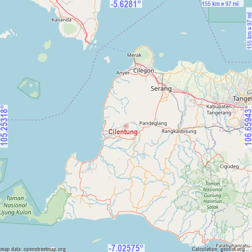
Cilentung GPS coordinates[2]
6° 19' 38.64" South, 105° 57' 22.68" East
| Map corner | latitude | longitude |
|---|---|---|
| Upper-left | -5.6281°, | 105.25318° |
| Center: | -6.3274°, | 105.9563° |
| Lower-right: | -7.02575°, | 106.65943° |
| Map W x H: | 155.4×155.4 km | = 96.6×96.6mi |
| max Lat: | 5.88969° ⇑13.5% North |
| Cilentung: | -6.3274° |
| min Lat: | ⇓86.5% South -10.934° |
| min Long | Cilentung | max Long |
| 95.1345° | 105.9563° | 140.9419° |
| W 8.4%⇐ | ⇒91.6% E |
Elevation
Elevation of Cilentung is 474 m = 1555 ft, and this is 244.3 m = 802 ft above average elevation for this country.
| Max E: |
3185 m = 10449 ft | 17.3% |
| Cilentung | 474 m 1555 ft | |
| Avg. | 229.7 m = 754 ft | |
Min E: |
-1 m = -3 ft | 82.7% |
See also: Indonesia elevation on elevation.city.
Geographical zone
Cilentung is located in South Torrid zone (between Equator and Tropic of Capricorn). Distance of Equator is 703.5 km =437.1 mi to North.| Distance of | km | miles | from Cilentung |
|---|---|---|---|
| Equator | 703.5 | 437.1 | to North |
| Tropic Capricorn | 1902.4 | 1182.1 | to South |
| Antarctic Circle | 6697.6 | 4161.7 | to South |
| South Pole | 9303.5 | 5780.9 | to South |


Nearby cities:
15 places around Cilentung: (largest is in red/bold)
• Barusatu
1.4 km =0.9 mi,  303°
303°
• Batulayang
4.7 km =2.9 mi,  23°
23°
• Bojongpinang
3.9 km =2.4 mi,  197°
197°
• Cigadung
3.8 km =2.4 mi,  259°
259°
• Cisaat
4.3 km =2.7 mi, 23°
• Kadubeureum
3.9 km =2.4 mi, 204°
• Kadujampang
3.2 km =2 mi,  41°
41°
• Kadupager
3.3 km =2.1 mi,  224°
224°
• Kaduranca
4.7 km =2.9 mi, 217°
• Kadutalahab
2.4 km =1.5 mi, 201°
• Mandalawangi
4 km =2.5 mi,  61°
61°
• Munjul
2.8 km =1.7 mi,  232°
232°
• Pandat
1.6 km =1 mi, 17°
• Pasargunung
4.1 km =2.5 mi,  186°
186°
• Talaga
4.9 km =3 mi,  81°
81°
Sources, notices
• [Note1] Compared only with cities in Indonesia existing in our database
• [Src1] Map data: © OpenStreetMap contributors (CC-BY-SA)
• [Src2] Other city data from geonames.org with taken over terms of usage.
• [Src3] Geographical zone / Annual Mean Temperature by Robert A. Rohde @ Wikipedia
