Balung geodata
Balung (East Java) is a populated place; located in Indonesia in Asia/Jakarta (GMT+7) time zone. With population of 47,631 people, there are 245 cities with bigger population in this country. Compared to other cities in Indonesia, 60.1% of cities are located further ↑North; 66.6% of cities are located further ←West and 73.4% of cities have higher elevation than Balung. Note1


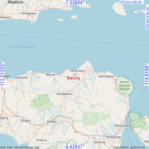
Balung GPS coordinates[2]
7° 43' 59.988" South, 113° 55' 0.012" East
| Map corner | latitude | longitude |
|---|---|---|
| Upper-left | -7.03604°, | 113.21355° |
| Center: | -7.73333°, | 113.91667° |
| Lower-right: | -8.42947°, | 114.6198° |
| Map W x H: | 154.9×154.9 km | = 96.3×96.3mi |
| max Lat: | 5.88969° ⇑60.1% North |
| Balung: | -7.73333° |
| min Lat: | ⇓39.9% South -10.934° |
| min Long | Balung | max Long |
| 95.1345° | 113.91667° | 140.9419° |
| W 66.6%⇐ | ⇒33.4% E |
Elevation
Elevation of Balung is 27 m = 89 ft, and this is 202.7 m = 665 ft below average elevation for this country.
| Max E: |
3185 m = 10449 ft | 73.4% |
| Avg. | 229.7 m = 754 ft | |
| Balung | 27 m = 89 ft | |
Min E: |
-1 m = -3 ft | 26.6% |
See also: Balung elevation on elevation.city.
Geographical zone
Balung is located in South Torrid zone (between Equator and Tropic of Capricorn). Distance of Equator is 859.9 km =534.3 mi to North.| Distance of | km | miles | from Balung |
|---|---|---|---|
| Equator | 859.9 | 534.3 | to North |
| Tropic Capricorn | 1746.1 | 1085 | to South |
| Antarctic Circle | 6541.3 | 4064.6 | to South |
| South Pole | 9147.2 | 5683.8 | to South |


Nearby cities:
15 places around Balung: (largest is in red/bold)
• Banyumas
12 km =7.5 mi,  126°
126°
• Cempaka
14.4 km =8.9 mi,  53°
53°
• Grujugan
11 km =6.8 mi,  116°
116°
• Gumuk Tengah
14.3 km =8.9 mi,  42°
42°
• Kotakan Selatan
10.3 km =6.4 mi,  97°
97°
• Krajan Bandilan
12.5 km =7.8 mi, 123°
• Krajan Battal
13.8 km =8.6 mi, 96°
• Krajan Panji Kidul
14 km =8.7 mi,  79°
79°
• Krajan Satu Panji Lor
14.4 km =8.9 mi,  73°
73°
• Mimbaan Timur
13 km =8.1 mi, 72°
• Panarukan
3.5 km =2.2 mi,  3°
3°
• Ramban Kulon
12.3 km =7.6 mi,  113°
113°
• Ramban Wetan
13.1 km =8.1 mi, 112°
• Situbondo
10.7 km =6.6 mi, 73°
• Sliwungkrajan
10.2 km =6.3 mi, 99°
Sources, notices
• [Note1] Compared only with cities in Indonesia existing in our database
• [Src1] Map data: © OpenStreetMap contributors (CC-BY-SA)
• [Src2] Other city data from geonames.org with taken over terms of usage.
• [Src3] Geographical zone / Annual Mean Temperature by Robert A. Rohde @ Wikipedia
