Spigno Saturnia Superiore geodata
Spigno Saturnia Superiore (Latium) is a seat of a third-order administrative division; located in Italy in Europe/Rome (GMT+2) time zone. With population of 231 people, there are 10973 cities with bigger population in this country. Compared to other cities in Italy, 76% of cities are located further ↑North; 75.7% of cities are located further ←West and 66.3% of cities have lower elevation than Spigno Saturnia Superiore. Note1
Current local time in Spigno Saturnia Superiore:
09:00 PM, WednesdayDifference from your time zone: hours


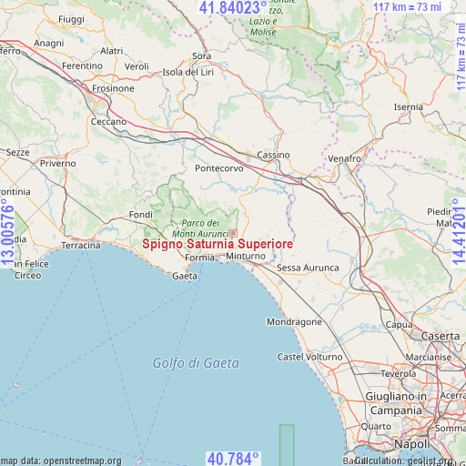
Spigno Saturnia Superiore GPS coordinates[2]
41° 18' 51.3" North, 13° 42' 31.968" East
| Map corner | latitude | longitude |
|---|---|---|
| Upper-left | 41.84023°, | 13.00576° |
| Center: | 41.31425°, | 13.70888° |
| Lower-right: | 40.784°, | 14.41201° |
| Map W x H: | 117.4×117.4 km | = 72.9×72.9mi |
| max Lat: | 47.04031° ⇑76% North |
| Spigno Saturnia Superiore: | 41.31425° |
| min Lat: | ⇓24% South 35.50142° |
| min Long | Spigno Saturnia | max Long |
| 6.69888° | 13.70888° | 18.48682° |
| W 75.7%⇐ | ⇒24.3% E |
Elevation
Elevation of Spigno Saturnia Superiore is 356 m = 1168 ft, and this is 49.3 m = 162 ft above average elevation for this country.
| Max E: |
2085 m = 6841 ft | 33.7% |
| Spigno Saturnia Superiore | 356 m 1168 ft | |
| Avg. | 306.7 m = 1006 ft | |
Min E: |
-4 m = -13 ft | 66.3% |
See also: Italy elevation on elevation.city.
Geographical zone
Spigno Saturnia Superiore is located in North temperate zone (between Tropic of Cancer and the Arctic Circle). Distance of this Northern Tropic circle is 1987.8 km =1235.2 mi to South.| Distance of | km | miles | from Spigno Saturnia Superiore |
|---|---|---|---|
| North Pole | 5413.3 | 3363.7 | to North |
| Arctic Circle | 2807.5 | 1744.5 | to North |
| Tropic Cancer | 1987.8 | 1235.2 | to South |
| Equator | 4593.7 | 2854.4 | to South |


Nearby cities:
15 places around Spigno Saturnia Superiore: (largest is in red/bold)
• Ausonia
6 km =3.7 mi,  35°
35°
• Casali
8.1 km =5 mi,  28°
28°
• Castelnuovo Parano
8.2 km =5.1 mi, 28°
• Cerri Aprano
6.4 km =4 mi,  115°
115°
• Coreno Ausonio
6.7 km =4.2 mi,  56°
56°
• Esperia
7.8 km =4.8 mi,  345°
345°
• Grunuovo-Campomaggiore San Luca
9.4 km =5.8 mi, 119°
• Maranola-Trivio
7.5 km =4.7 mi,  244°
244°
• Minturno
6.5 km =4 mi,  151°
151°
• Penitro
4.8 km =3 mi,  196°
196°
• Santa Maria Infante
3.8 km =2.4 mi,  136°
136°
• Santi Cosma e Damiano
9 km =5.6 mi,  99°
99°
• Spigno Saturnia Inferiore
2.4 km =1.5 mi, 97°
• Tufo
7 km =4.3 mi, 138°
• Vallemaio
10.1 km =6.3 mi, 55°
Sources, notices
• [Note1] Compared only with cities in Italy existing in our database
• [Src1] Map data: © OpenStreetMap contributors (CC-BY-SA)
• [Src2] Other city data from geonames.org with taken over terms of usage.
• [Src3] Geographical zone / Annual Mean Temperature by Robert A. Rohde @ Wikipedia
