Licenza geodata
Licenza (Latium) is a seat of a third-order administrative division; located in Italy in Europe/Rome (GMT+2) time zone. With population of 935 people, there are 6956 cities with bigger population in this country. Compared to other cities in Italy, 69.7% of cities are located further ↑North; 67.2% of cities are located further ←West and 76.6% of cities have lower elevation than Licenza. Note1
Administrative division(s):
- Level 1: Latium
- Level 2: Città metropolitana di Roma Capitale
- Level 3: Licenza


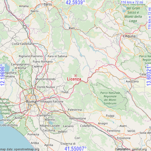
Licenza GPS coordinates[2]
42° 4' 26.868" North, 12° 54' 0.288" East
| Map corner | latitude | longitude |
|---|---|---|
| Upper-left | 42.5939°, | 12.19696° |
| Center: | 42.07413°, | 12.90008° |
| Lower-right: | 41.55007°, | 13.60321° |
| Map W x H: | 116.1×116.1 km | = 72.1×72.1mi |
| max Lat: | 47.04031° ⇑69.7% North |
| Licenza: | 42.07413° |
| min Lat: | ⇓30.3% South 35.50142° |
| min Long | Licenza | max Long |
| 6.69888° | 12.90008° | 18.48682° |
| W 67.2%⇐ | ⇒32.8% E |
Elevation
Elevation of Licenza is 475 m = 1558 ft, and this is 168.3 m = 552 ft above average elevation for this country.
| Max E: |
2085 m = 6841 ft | 23.4% |
| Licenza | 475 m 1558 ft | |
| Avg. | 306.7 m = 1006 ft | |
Min E: |
-4 m = -13 ft | 76.6% |
See also: Italy elevation on elevation.city.
Geographical zone
Licenza is located in North temperate zone (between Tropic of Cancer and the Arctic Circle). Distance of this Northern Tropic circle is 2072.3 km =1287.7 mi to South.| Distance of | km | miles | from Licenza |
|---|---|---|---|
| North Pole | 5328.9 | 3311.2 | to North |
| Arctic Circle | 2723 | 1692 | to North |
| Tropic Cancer | 2072.3 | 1287.7 | to South |
| Equator | 4678.2 | 2906.9 | to South |


Nearby cities:
15 places around Licenza: (largest is in red/bold)
• Arsoli
10.2 km =6.3 mi,  110°
110°
• Cineto Romano
5.7 km =3.5 mi,  118°
118°
• Mandela
5.4 km =3.4 mi,  161°
161°
• Marcellina
9.6 km =6 mi,  234°
234°
• Monteflavio
6.9 km =4.3 mi,  304°
304°
• Orvinio
7 km =4.3 mi,  26°
26°
• Percile
2.5 km =1.6 mi,  20°
20°
• Riofreddo
8.1 km =5 mi,  102°
102°
• Roccagiovine
2.6 km =1.6 mi,  181°
181°
• Roviano
9.4 km =5.8 mi, 124°
• San Polo dei Cavalieri
8.7 km =5.4 mi,  215°
215°
• Saracinesco
9 km =5.6 mi,  150°
150°
• Vallinfreda
8 km =5 mi,  81°
81°
• Vicovaro
6.1 km =3.8 mi, 180°
• Vivaro Romano
9.2 km =5.7 mi,  71°
71°
Sources, notices
• [Note1] Compared only with cities in Italy existing in our database
• [Src1] Map data: © OpenStreetMap contributors (CC-BY-SA)
• [Src2] Other city data from geonames.org with taken over terms of usage.
• [Src3] Geographical zone / Annual Mean Temperature by Robert A. Rohde @ Wikipedia
