Cesa geodata
Cesa (Campania) is a seat of a third-order administrative division; located in Italy in Europe/Rome (GMT+2) time zone. With population of 8,496 people, there are 1122 cities with bigger population in this country. Compared to other cities in Italy, 79% of cities are located further ↑North; 80.1% of cities are located further ←West and 81.2% of cities have higher elevation than Cesa. Note1


Cesa GPS coordinates[2]
40° 57' 46.332" North, 14° 13' 50.916" East
| Map corner | latitude | longitude |
|---|---|---|
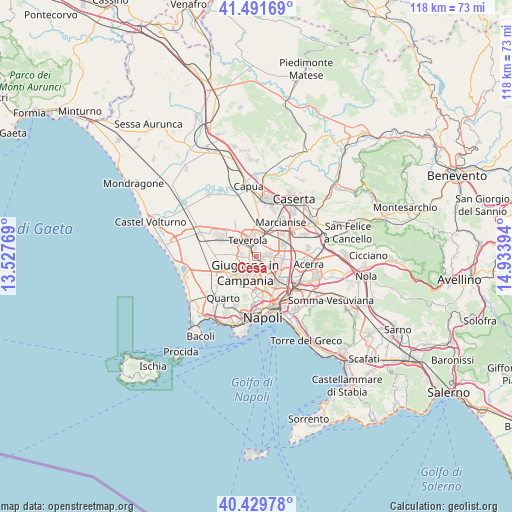
| Upper-left | 41.49169°, | 13.52769° |
| Center: | 40.96287°, | 14.23081° |
| Lower-right: | 40.42978°, | 14.93394° |
| Map W x H: | 118.1×118.1 km | = 73.4×73.4mi |
| max Lat: | 47.04031° ⇑79% North |
| Cesa: | 40.96287° |
| min Lat: | ⇓21% South 35.50142° |
| min Long | Cesa | max Long |
| 6.69888° | 14.23081° | 18.48682° |
| W 80.1%⇐ | ⇒19.9% E |
Elevation
Elevation of Cesa is 45 m = 148 ft, and this is 261.7 m = 859 ft below average elevation for this country.
| Max E: |
2085 m = 6841 ft | 81.2% |
| Avg. | 306.7 m = 1006 ft | |
| Cesa | 45 m = 148 ft | |
Min E: |
-4 m = -13 ft | 18.8% |
See also: Italy elevation on elevation.city.
Geographical zone
Cesa is located in North temperate zone (between Tropic of Cancer and the Arctic Circle). Distance of this Northern Tropic circle is 1948.7 km =1210.9 mi to South.| Distance of | km | miles | from Cesa |
|---|---|---|---|
| North Pole | 5452.4 | 3388 | to North |
| Arctic Circle | 2846.5 | 1768.7 | to North |
| Tropic Cancer | 1948.7 | 1210.9 | to South |
| Equator | 4554.6 | 2830.1 | to South |


Nearby cities:
15 places around Cesa: (largest is in red/bold)
• Aversa
2.2 km =1.4 mi,  298°
298°
• Carinaro
2.4 km =1.5 mi,  337°
337°
• Casandrino
4.1 km =2.5 mi,  159°
159°
• Frattamaggiore
4.5 km =2.8 mi,  122°
122°
• Frattaminore
3.5 km =2.2 mi,  102°
102°
• Giugliano in Campania
4.5 km =2.8 mi,  212°
212°
• Gricignano di Aversa
1.9 km =1.2 mi,  0°
0°
• Grumo Nevano
3.9 km =2.4 mi,  140°
140°
• Lusciano
3.5 km =2.2 mi,  283°
283°
• Melito di Napoli
4.8 km =3 mi,  179°
179°
• Orta di Atella
3.2 km =2 mi,  86°
86°
• Sant'Antimo
2.3 km =1.4 mi,  171°
171°
• Sant'Arpino
1.8 km =1.1 mi,  110°
110°
• Succivo
2.2 km =1.4 mi,  74°
74°
• Teverola
4.1 km =2.5 mi,  331°
331°
Sources, notices
• [Note1] Compared only with cities in Italy existing in our database
• [Src1] Map data: © OpenStreetMap contributors (CC-BY-SA)
• [Src2] Other city data from geonames.org with taken over terms of usage.
• [Src3] Geographical zone / Annual Mean Temperature by Robert A. Rohde @ Wikipedia
