Amaseno geodata
Amaseno (Latium) is a seat of a third-order administrative division; located in Italy in Europe/Rome (GMT+2) time zone. With population of 1,616 people, there are 4864 cities with bigger population in this country. Compared to other cities in Italy, 75.1% of cities are located further ↑North; 71.8% of cities are located further ←West and 69.3% of cities have higher elevation than Amaseno. Note1


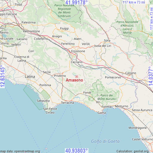
Amaseno GPS coordinates[2]
41° 28' 1.38" North, 13° 20' 4.452" East
| Map corner | latitude | longitude |
|---|---|---|
| Upper-left | 41.99178°, | 12.63145° |
| Center: | 41.46705°, | 13.33457° |
| Lower-right: | 40.93803°, | 14.0377° |
| Map W x H: | 117.2×117.2 km | = 72.8×72.8mi |
| max Lat: | 47.04031° ⇑75.1% North |
| Amaseno: | 41.46705° |
| min Lat: | ⇓24.9% South 35.50142° |
| min Long | Amaseno | max Long |
| 6.69888° | 13.33457° | 18.48682° |
| W 71.8%⇐ | ⇒28.2% E |
Elevation
Elevation of Amaseno is 101 m = 331 ft, and this is 205.7 m = 675 ft below average elevation for this country.
| Max E: |
2085 m = 6841 ft | 69.3% |
| Avg. | 306.7 m = 1006 ft | |
| Amaseno | 101 m = 331 ft | |
Min E: |
-4 m = -13 ft | 30.7% |
See also: Italy elevation on elevation.city.
Geographical zone
Amaseno is located in North temperate zone (between Tropic of Cancer and the Arctic Circle). Distance of this Northern Tropic circle is 2004.8 km =1245.7 mi to South.| Distance of | km | miles | from Amaseno |
|---|---|---|---|
| North Pole | 5396.4 | 3353.2 | to North |
| Arctic Circle | 2790.5 | 1733.9 | to North |
| Tropic Cancer | 2004.8 | 1245.7 | to South |
| Equator | 4610.7 | 2865 | to South |


Nearby cities:
15 places around Amaseno: (largest is in red/bold)
• Castro dei Volsci
7.5 km =4.7 mi,  52°
52°
• Ceccano
11.7 km =7.3 mi,  357°
357°
• Farneta
10.7 km =6.6 mi,  10°
10°
• Giuliano di Roma
9.2 km =5.7 mi,  330°
330°
• Lenola
12.5 km =7.8 mi,  123°
123°
• Madonna del Piano
8 km =5 mi, 46°
• Monte San Biagio
12.7 km =7.9 mi,  173°
173°
• Pofi
12.8 km =8 mi,  31°
31°
• Prossedi
8.3 km =5.2 mi,  312°
312°
• Roccasecca dei Volsci
10.2 km =6.3 mi,  277°
277°
• Scalo
11.9 km =7.4 mi,  251°
251°
• Sonnino
9.3 km =5.8 mi,  232°
232°
• Valle Bernardo
12.3 km =7.6 mi,  134°
134°
• Vallecorsa
6.5 km =4 mi,  113°
113°
• Villa Santo Stefano
5.9 km =3.7 mi,  340°
340°
Sources, notices
• [Note1] Compared only with cities in Italy existing in our database
• [Src1] Map data: © OpenStreetMap contributors (CC-BY-SA)
• [Src2] Other city data from geonames.org with taken over terms of usage.
• [Src3] Geographical zone / Annual Mean Temperature by Robert A. Rohde @ Wikipedia
