Agordo geodata
Agordo (Veneto) is a seat of a third-order administrative division; located in Italy in Europe/Rome (GMT+2) time zone. With population of 3,861 people, there are 2475 cities with bigger population in this country. Compared to other cities in Italy, 96.7% of cities are located further ↓South; 56.3% of cities are located further ←West and 85.3% of cities have lower elevation than Agordo. Note1


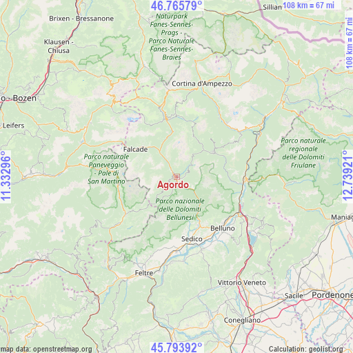
Agordo GPS coordinates[2]
46° 16' 55.236" North, 12° 2' 9.888" East
| Map corner | latitude | longitude |
|---|---|---|
| Upper-left | 46.76579°, | 11.33296° |
| Center: | 46.28201°, | 12.03608° |
| Lower-right: | 45.79392°, | 12.73921° |
| Map W x H: | 108.1×108.1 km | = 67.2×67.2mi |
| max Lat: | 47.04031° ⇑3.3% North |
| Agordo: | 46.28201° |
| min Lat: | ⇓96.7% South 35.50142° |
| min Long | Agordo | max Long |
| 6.69888° | 12.03608° | 18.48682° |
| W 56.3%⇐ | ⇒43.7% E |
Elevation
Elevation of Agordo is 619 m = 2031 ft, and this is 312.3 m = 1025 ft above average elevation for this country.
| Max E: |
2085 m = 6841 ft | 14.7% |
| Agordo | 619 m 2031 ft | |
| Avg. | 306.7 m = 1006 ft | |
Min E: |
-4 m = -13 ft | 85.3% |
See also: Italy elevation on elevation.city.
Geographical zone
Agordo is located in North temperate zone (between Tropic of Cancer and the Arctic Circle). Distance of this North polar circle is 2255.1 km =1401.3 mi to North.| Distance of | km | miles | from Agordo |
|---|---|---|---|
| North Pole | 4861 | 3020.5 | to North |
| Arctic Circle | 2255.1 | 1401.3 | to North |
| Tropic Cancer | 2540.2 | 1578.4 | to South |
| Equator | 5146.1 | 3197.6 | to South |


Nearby cities:
15 places around Agordo: (largest is in red/bold)
• Canale d'Agordo
12.5 km =7.8 mi,  311°
311°
• Celat-San Tomaso Agordino
12 km =7.5 mi,  336°
336°
• Cencenighe Agordino
9.4 km =5.8 mi,  326°
326°
• Don
9.1 km =5.7 mi,  222°
222°
• Fusine
12.5 km =7.8 mi,  33°
33°
• Gosaldo
9.1 km =5.7 mi, 222°
• La Valle Agordina
2.5 km =1.6 mi,  90°
90°
• Rivamonte Agordino
3.5 km =2.2 mi,  196°
196°
• Sachet
12.7 km =7.9 mi,  320°
320°
• Sagron Mis
12.1 km =7.5 mi, 216°
• Taibon Agordino
2.5 km =1.6 mi, 315°
• Vallada Agordina
12.1 km =7.5 mi, 319°
• Voltago
2.5 km =1.6 mi,  245°
245°
• Voltago Agordino
2.6 km =1.6 mi,  243°
243°
• Zoldo Alto
12.5 km =7.8 mi, 33°
Sources, notices
• [Note1] Compared only with cities in Italy existing in our database
• [Src1] Map data: © OpenStreetMap contributors (CC-BY-SA)
• [Src2] Other city data from geonames.org with taken over terms of usage.
• [Src3] Geographical zone / Annual Mean Temperature by Robert A. Rohde @ Wikipedia
