Assago geodata
Assago (Lombardy) is a seat of a third-order administrative division; located in Italy in Europe/Rome (GMT+2) time zone. With population of 7,917 people, there are 1231 cities with bigger population in this country. Compared to other cities in Italy, 70.5% of cities are located further ↓South; 79.2% of cities are located further →East and 68.3% of cities have higher elevation than Assago. Note1
Administrative division(s):
- Level 1: Lombardy
- Level 2: Città metropolitana di Milano
- Level 3: Assago


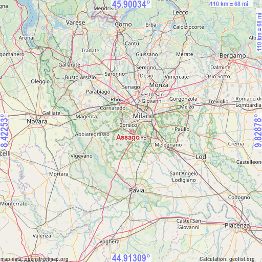
Assago GPS coordinates[2]
45° 24' 31.932" North, 9° 7' 32.34" East
| Map corner | latitude | longitude |
|---|---|---|
| Upper-left | 45.90034°, | 8.42253° |
| Center: | 45.40887°, | 9.12565° |
| Lower-right: | 44.91309°, | 9.82878° |
| Map W x H: | 109.8×109.8 km | = 68.2×68.2mi |
| max Lat: | 47.04031° ⇑29.5% North |
| Assago: | 45.40887° |
| min Lat: | ⇓70.5% South 35.50142° |
| min Long | Assago | max Long |
| 6.69888° | 9.12565° | 18.48682° |
| W 20.8%⇐ | ⇒79.2% E |
Elevation
Elevation of Assago is 107 m = 351 ft, and this is 199.7 m = 655 ft below average elevation for this country.
| Max E: |
2085 m = 6841 ft | 68.3% |
| Avg. | 306.7 m = 1006 ft | |
| Assago | 107 m = 351 ft | |
Min E: |
-4 m = -13 ft | 31.7% |
See also: Italy elevation on elevation.city.
Geographical zone
Assago is located in North temperate zone (between Tropic of Cancer and the Arctic Circle). Distance of this North polar circle is 2352.2 km =1461.6 mi to North.| Distance of | km | miles | from Assago |
|---|---|---|---|
| North Pole | 4958.1 | 3080.8 | to North |
| Arctic Circle | 2352.2 | 1461.6 | to North |
| Tropic Cancer | 2443.1 | 1518.1 | to South |
| Equator | 5049 | 3137.3 | to South |


Nearby cities:
15 places around Assago: (largest is in red/bold)
• Badile
6.5 km =4 mi,  179°
179°
• Basiglio
6.1 km =3.8 mi,  155°
155°
• Buccinasco
1.4 km =0.9 mi,  261°
261°
• Cesano Boscone
4.4 km =2.7 mi,  326°
326°
• Corsico
2.7 km =1.7 mi, 334°
• Fizzonasco
6.5 km =4 mi,  128°
128°
• Gaggiano
7.1 km =4.4 mi,  266°
266°
• Moirago
4.5 km =2.8 mi,  168°
168°
• Noverasco-Sporting Mirasole
7.1 km =4.4 mi,  102°
102°
• Romano Banco
2.1 km =1.3 mi,  317°
317°
• Ronchetto Delle Rane
4.5 km =2.8 mi, 101°
• Rozzano
3.8 km =2.4 mi,  141°
141°
• San Pietro
3.8 km =2.4 mi,  214°
214°
• Trezzano sul Naviglio
5.1 km =3.2 mi,  286°
286°
• Zibido San Giacomo
5.5 km =3.4 mi,  191°
191°
Sources, notices
• [Note1] Compared only with cities in Italy existing in our database
• [Src1] Map data: © OpenStreetMap contributors (CC-BY-SA)
• [Src2] Other city data from geonames.org with taken over terms of usage.
• [Src3] Geographical zone / Annual Mean Temperature by Robert A. Rohde @ Wikipedia
