Albuccione geodata
Albuccione (Latium) is a populated place; located in Italy in Europe/Rome (GMT+2) time zone. With population of 2,661 people, there are 3355 cities with bigger population in this country. Compared to other cities in Italy, 70.8% of cities are located further ↑North; 65% of cities are located further ←West and 77.7% of cities have higher elevation than Albuccione. Note1
Administrative division(s):
- Level 1: Latium
- Level 2: Città metropolitana di Roma Capitale
- Level 3: Guidonia Montecelio


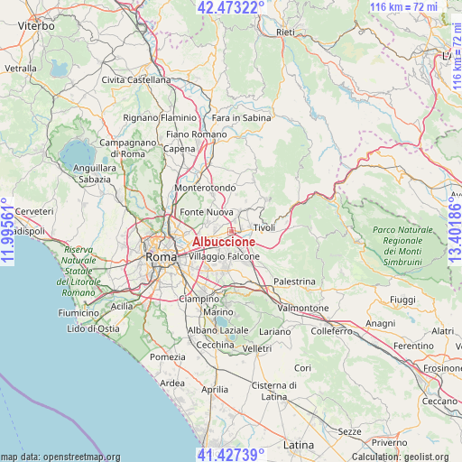
Albuccione GPS coordinates[2]
41° 57' 8.82" North, 12° 41' 55.428" East
| Map corner | latitude | longitude |
|---|---|---|
| Upper-left | 42.47322°, | 11.99561° |
| Center: | 41.95245°, | 12.69873° |
| Lower-right: | 41.42739°, | 13.40186° |
| Map W x H: | 116.3×116.3 km | = 72.3×72.3mi |
| max Lat: | 47.04031° ⇑70.8% North |
| Albuccione: | 41.95245° |
| min Lat: | ⇓29.2% South 35.50142° |
| min Long | Albuccione | max Long |
| 6.69888° | 12.69873° | 18.48682° |
| W 65%⇐ | ⇒35% E |
Elevation
Elevation of Albuccione is 61 m = 200 ft, and this is 245.7 m = 806 ft below average elevation for this country.
| Max E: |
2085 m = 6841 ft | 77.7% |
| Avg. | 306.7 m = 1006 ft | |
| Albuccione | 61 m = 200 ft | |
Min E: |
-4 m = -13 ft | 22.3% |
See also: Italy elevation on elevation.city.
Geographical zone
Albuccione is located in North temperate zone (between Tropic of Cancer and the Arctic Circle). Distance of this Northern Tropic circle is 2058.8 km =1279.3 mi to South.| Distance of | km | miles | from Albuccione |
|---|---|---|---|
| North Pole | 5342.4 | 3319.6 | to North |
| Arctic Circle | 2736.5 | 1700.4 | to North |
| Tropic Cancer | 2058.8 | 1279.3 | to South |
| Equator | 4664.7 | 2898.5 | to South |


Nearby cities:
15 places around Albuccione: (largest is in red/bold)
• Bagni di Tivoli
1.5 km =0.9 mi,  100°
100°
• Campo Limpido-Favale
6.1 km =3.8 mi,  74°
74°
• Colleverde II
6.1 km =3.8 mi,  294°
294°
• Forno Casale
5.1 km =3.2 mi,  262°
262°
• Fosso di San Giuliano
5 km =3.1 mi,  169°
169°
• Guidonia
4.7 km =2.9 mi,  20°
20°
• Guidonia Montecelio
5 km =3.1 mi, 23°
• Laghetto
3.9 km =2.4 mi,  295°
295°
• Marco Simone
4.2 km =2.6 mi,  274°
274°
• Pichini
5.6 km =3.5 mi,  346°
346°
• Santa Lucia
4.8 km =3 mi,  313°
313°
• Setteville
4 km =2.5 mi, 256°
• Villa Adriana
6.1 km =3.8 mi,  87°
87°
• Villalba
2.5 km =1.6 mi, 86°
• Villanova
4.9 km =3 mi,  75°
75°
Sources, notices
• [Note1] Compared only with cities in Italy existing in our database
• [Src1] Map data: © OpenStreetMap contributors (CC-BY-SA)
• [Src2] Other city data from geonames.org with taken over terms of usage.
• [Src3] Geographical zone / Annual Mean Temperature by Robert A. Rohde @ Wikipedia
