Fumo geodata
Fumo (Lombardy) is a populated place; located in Italy in Europe/Rome (GMT+2) time zone. With population of 700 people, there are 8299 cities with bigger population in this country. Compared to other cities in Italy, 60.5% of cities are located further ↓South; 78.8% of cities are located further →East and 70.6% of cities have higher elevation than Fumo. Note1
Administrative division(s):
- Level 1: Lombardy
- Level 2: Provincia di Pavia
- Level 3: Corvino San Quirico


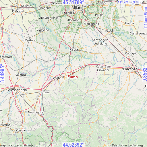
Fumo GPS coordinates[2]
45° 1' 23.016" North, 9° 9' 11.052" East
| Map corner | latitude | longitude |
|---|---|---|
| Upper-left | 45.51789°, | 8.44995° |
| Center: | 45.02306°, | 9.15307° |
| Lower-right: | 44.52392°, | 9.8562° |
| Map W x H: | 110.5×110.5 km | = 68.7×68.7mi |
| max Lat: | 47.04031° ⇑39.5% North |
| Fumo: | 45.02306° |
| min Lat: | ⇓60.5% South 35.50142° |
| min Long | Fumo | max Long |
| 6.69888° | 9.15307° | 18.48682° |
| W 21.2%⇐ | ⇒78.8% E |
Elevation
Elevation of Fumo is 94 m = 308 ft, and this is 212.7 m = 698 ft below average elevation for this country.
| Max E: |
2085 m = 6841 ft | 70.6% |
| Avg. | 306.7 m = 1006 ft | |
| Fumo | 94 m = 308 ft | |
Min E: |
-4 m = -13 ft | 29.4% |
See also: Italy elevation on elevation.city.
Geographical zone
Fumo is located in North temperate zone (between Tropic of Cancer and the Arctic Circle). Distance of this North polar circle is 2395.1 km =1488.2 mi to North.| Distance of | km | miles | from Fumo |
|---|---|---|---|
| North Pole | 5001 | 3107.5 | to North |
| Arctic Circle | 2395.1 | 1488.2 | to North |
| Tropic Cancer | 2400.2 | 1491.4 | to South |
| Equator | 5006.1 | 3110.6 | to South |


Nearby cities:
15 places around Fumo: (largest is in red/bold)
• Calvignano
4.6 km =2.9 mi,  164°
164°
• Casatisma
3.1 km =1.9 mi,  325°
325°
• Casteggio
2.4 km =1.5 mi,  245°
245°
• Corvino San Quirico
1.5 km =0.9 mi,  151°
151°
• Montebello
4.7 km =2.9 mi,  237°
237°
• Mornico
4.6 km =2.9 mi,  107°
107°
• Mornico Losana
4.4 km =2.7 mi, 108°
• Oliva Gessi
2.5 km =1.6 mi,  140°
140°
• Pinarolo Po
5.3 km =3.3 mi,  12°
12°
• Redavalle
4.2 km =2.6 mi,  66°
66°
• Robecco Pavese
2.8 km =1.7 mi,  355°
355°
• San Rocco
1.7 km =1.1 mi, 155°
• Santa Giuletta
2.5 km =1.6 mi,  61°
61°
• Torricella Verzate
1.6 km =1 mi,  102°
102°
• Verretto
3.6 km =2.2 mi,  300°
300°
Sources, notices
• [Note1] Compared only with cities in Italy existing in our database
• [Src1] Map data: © OpenStreetMap contributors (CC-BY-SA)
• [Src2] Other city data from geonames.org with taken over terms of usage.
• [Src3] Geographical zone / Annual Mean Temperature by Robert A. Rohde @ Wikipedia
