Canalello geodata
Canalello (Calabria) is a populated place; located in Italy in Europe/Rome (GMT+2) time zone. With population of 643 people, there are 8685 cities with bigger population in this country. Compared to other cities in Italy, 96.4% of cities are located further ↑North; 93.8% of cities are located further ←West and 95.3% of cities have higher elevation than Canalello. Note1
Administrative division(s):
- Level 1: Calabria
- Level 2: Provincia di Reggio Calabria
- Level 3: Ferruzzano


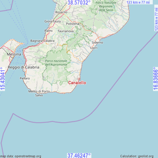
Canalello GPS coordinates[2]
38° 1' 6.564" North, 16° 8' 0.708" East
| Map corner | latitude | longitude |
|---|---|---|
| Upper-left | 38.57032°, | 15.43041° |
| Center: | 38.01849°, | 16.13353° |
| Lower-right: | 37.46247°, | 16.83666° |
| Map W x H: | 123.2×123.2 km | = 76.6×76.6mi |
| max Lat: | 47.04031° ⇑96.4% North |
| Canalello: | 38.01849° |
| min Lat: | ⇓3.6% South 35.50142° |
| min Long | Canalello | max Long |
| 6.69888° | 16.13353° | 18.48682° |
| W 93.8%⇐ | ⇒6.2% E |
Elevation
Elevation of Canalello is 8 m = 26 ft, and this is 298.7 m = 980 ft below average elevation for this country.
| Max E: |
2085 m = 6841 ft | 95.3% |
| Avg. | 306.7 m = 1006 ft | |
| Canalello | 8 m = 26 ft | |
Min E: |
-4 m = -13 ft | 4.7% |
See also: Italy elevation on elevation.city.
Geographical zone
Canalello is located in North temperate zone (between Tropic of Cancer and the Arctic Circle). Distance of this Northern Tropic circle is 1621.3 km =1007.4 mi to South.| Distance of | km | miles | from Canalello |
|---|---|---|---|
| North Pole | 5779.8 | 3591.4 | to North |
| Arctic Circle | 3173.9 | 1972.2 | to North |
| Tropic Cancer | 1621.3 | 1007.4 | to South |
| Equator | 4227.3 | 2626.7 | to South |


Nearby cities:
15 places around Canalello: (largest is in red/bold)
• Africo Nuovo
3.6 km =2.2 mi,  359°
359°
• Bianco
8.3 km =5.2 mi,  10°
10°
• Bosco Sant'Ippolito
13 km =8.1 mi,  2°
2°
• Bosco-Belloro
13.7 km =8.5 mi, 357°
• Brancaleone
6.8 km =4.2 mi,  205°
205°
• Brancaleone-Marina
6.5 km =4 mi, 207°
• Bruzzano Zeffirio
4.5 km =2.8 mi,  262°
262°
• Caraffa del Bianco
9.2 km =5.7 mi,  334°
334°
• Casignana
10 km =6.2 mi,  337°
337°
• Ferruzzano
4.4 km =2.7 mi,  297°
297°
• Palizzi
14.1 km =8.8 mi,  245°
245°
• Samo
9 km =5.6 mi,  313°
313°
• Sant'Agata del Bianco
9.4 km =5.8 mi, 331°
• Staiti
9 km =5.6 mi, 256°
• Weather Station
7 km =4.3 mi, 205°
Sources, notices
• [Note1] Compared only with cities in Italy existing in our database
• [Src1] Map data: © OpenStreetMap contributors (CC-BY-SA)
• [Src2] Other city data from geonames.org with taken over terms of usage.
• [Src3] Geographical zone / Annual Mean Temperature by Robert A. Rohde @ Wikipedia
