Chiaia geodata
Chiaia (Campania) is a section of populated place; located in Italy in Europe/Rome (GMT+2) time zone. With population of 38,356 people, there are 189 cities with bigger population in this country. Compared to other cities in Italy, 81% of cities are located further ↑North; 80.1% of cities are located further ←West and 96.6% of cities have higher elevation than Chiaia. Note1
Administrative division(s):
- Level 1: Campania
- Level 2: Napoli
- Level 3: Napoli
- Level 4: Municipalità 1


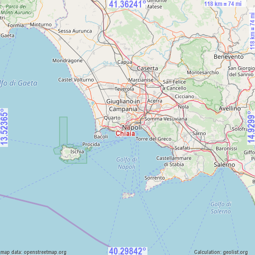
Chiaia GPS coordinates[2]
40° 49' 57.18" North, 14° 13' 36.372" East
| Map corner | latitude | longitude |
|---|---|---|
| Upper-left | 41.36241°, | 13.52365° |
| Center: | 40.83255°, | 14.22677° |
| Lower-right: | 40.29842°, | 14.9299° |
| Map W x H: | 118.3×118.3 km | = 73.5×73.5mi |
| max Lat: | 47.04031° ⇑81% North |
| Chiaia: | 40.83255° |
| min Lat: | ⇓19% South 35.50142° |
| min Long | Chiaia | max Long |
| 6.69888° | 14.22677° | 18.48682° |
| W 80.1%⇐ | ⇒19.9% E |
Elevation
Elevation of Chiaia is 6 m = 20 ft, and this is 300.7 m = 987 ft below average elevation for this country.
| Max E: |
2085 m = 6841 ft | 96.6% |
| Avg. | 306.7 m = 1006 ft | |
| Chiaia | 6 m = 20 ft | |
Min E: |
-4 m = -13 ft | 3.4% |
See also: Italy elevation on elevation.city.
Geographical zone
Chiaia is located in North temperate zone (between Tropic of Cancer and the Arctic Circle). Distance of this Northern Tropic circle is 1934.2 km =1201.9 mi to South.| Distance of | km | miles | from Chiaia |
|---|---|---|---|
| North Pole | 5466.9 | 3397 | to North |
| Arctic Circle | 2861 | 1777.7 | to North |
| Tropic Cancer | 1934.2 | 1201.9 | to South |
| Equator | 4540.2 | 2821.1 | to South |


Nearby cities:
15 places around Chiaia: (largest is in red/bold)
• Arenella
2.8 km =1.7 mi,  353°
353°
• Avvocata
2.8 km =1.7 mi,  29°
29°
• Fuorigrotta
2.3 km =1.4 mi,  272°
272°
• Mercato
4.1 km =2.5 mi,  69°
69°
• Montecalvario
2.1 km =1.3 mi,  50°
50°
• Naples
4.1 km =2.5 mi,  57°
57°
• Pendino
3.5 km =2.2 mi, 62°
• Porto
2.9 km =1.8 mi, 63°
• Posillipo
3.1 km =1.9 mi,  225°
225°
• San Ferdinando
1.7 km =1.1 mi,  86°
86°
• San Giuseppe
2.5 km =1.6 mi, 56°
• San Lorenzo
4.2 km =2.6 mi, 49°
• Soccavo
3.2 km =2 mi,  296°
296°
• Stella
3.8 km =2.4 mi, 34°
• Vomero
1.2 km =0.7 mi,  16°
16°
Sources, notices
• [Note1] Compared only with cities in Italy existing in our database
• [Src1] Map data: © OpenStreetMap contributors (CC-BY-SA)
• [Src2] Other city data from geonames.org with taken over terms of usage.
• [Src3] Geographical zone / Annual Mean Temperature by Robert A. Rohde @ Wikipedia
