Napari Village geodata
Napari Village (Line Islands) is a seat of a third-order administrative division; located in Kiribati in Pacific/Kiritimati (GMT+14) time zone. With population of 194 people, there are 35 cities with bigger population in this country. Compared to other cities in Kiribati, 100% of cities are located further ↓South; 100% of cities are located further →East and 80% of cities have higher elevation than Napari Village. Note1


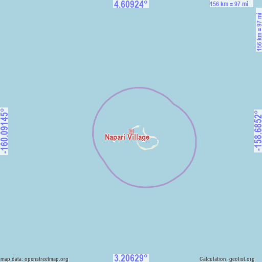
Napari Village GPS coordinates[2]
3° 54' 29.016" North, 159° 23' 17.952" West
| Map corner | latitude | longitude |
|---|---|---|
| Upper-left | 4.60924°, | -160.09145° |
| Center: | 3.90806°, | -159.38832° |
| Lower-right: | 3.20629°, | -158.6852° |
| Map W x H: | 156×156 km | = 96.9×96.9mi |
| max Lat: | 3.90806° ⇑0% North |
| Napari Village: | 3.90806° |
| min Lat: | ⇓100% South -2.65512° |
| min Long | Napari Village | max Long |
| -159.38832° | -159.38832° | 176.83302° |
| W 0%⇐ | ⇒100% E |
Elevation
Elevation of Napari Village is 9 m = 30 ft, and this is 0.9 m = 3 ft below average elevation for this country.
| Max E: |
13 m = 43 ft | 80% |
| Avg. | 9.9 m = 32 ft | |
| Napari Village | 9 m = 30 ft | |
Min E: |
6 m = 20 ft | 20% |
See also: Kiribati elevation on elevation.city.
Geographical zone
Napari Village is located in North Torrid zone (between Equator and Tropic of Cancer). Distance of Equator is 434.5 km =270 mi to South.| Distance of | km | miles | from Napari Village |
|---|---|---|---|
| North Pole | 9572.5 | 5948.1 | to North |
| Arctic Circle | 6966.6 | 4328.8 | to North |
| Tropic Cancer | 2171.4 | 1349.2 | to North |
| Equator | 434.5 | 270 | to South |


Nearby cities:
3 places around Napari Village: (largest is in red/bold)
• Banana Village
310.3 km =192.8 mi,  133°
133°
• London Village
301.4 km =187.3 mi,  135°
135°
• Tabwakea Village
297.9 km =185.1 mi, 134°
Sources, notices
• [Note1] Compared only with cities in Kiribati existing in our database
• [Src1] Map data: © OpenStreetMap contributors (CC-BY-SA)
• [Src2] Other city data from geonames.org with taken over terms of usage.
• [Src3] Geographical zone / Annual Mean Temperature by Robert A. Rohde @ Wikipedia
