Sandy Point Town geodata
Sandy Point Town (Saint Anne Sandy Point) is a seat of a first-order administrative division; located in Saint Kitts and Nevis in America/St_Kitts (GMT-4) time zone. With population of 780 people, there are 10 cities with bigger population in this country. Compared to other cities in Saint Kitts and Nevis, 68.8% of cities are located further ↓South; 100% of cities are located further →East and 81.2% of cities have higher elevation than Sandy Point Town. Note1


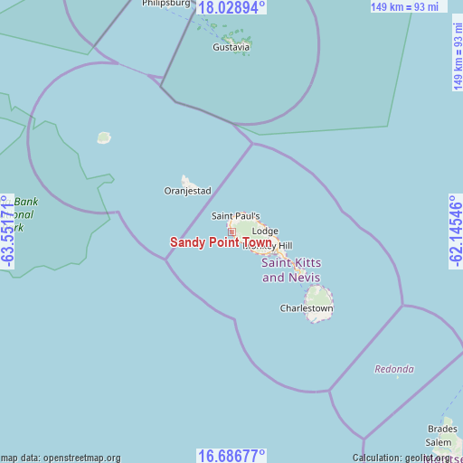
Sandy Point Town GPS coordinates[2]
17° 21' 32.688" North, 62° 50' 54.888" West
| Map corner | latitude | longitude |
|---|---|---|
| Upper-left | 18.02894°, | -63.55171° |
| Center: | 17.35908°, | -62.84858° |
| Lower-right: | 16.68677°, | -62.14546° |
| Map W x H: | 149.2×149.2 km | = 92.7×92.7mi |
| max Lat: | 17.41473° ⇑31.2% North |
| Sandy Point Town: | 17.35908° |
| min Lat: | ⇓68.8% South 17.12623° |
| min Long | Sandy Point Tow | max Long |
| -62.84858° | -62.84858° | -62.57267° |
| W 0%⇐ | ⇒100% E |
Elevation
Elevation of Sandy Point Town is 23 m = 75 ft, and this is 40.1 m = 132 ft below average elevation for this country.
| Max E: |
220 m = 722 ft | 81.2% |
| Avg. | 63.1 m = 207 ft | |
| Sandy Point Town | 23 m = 75 ft | |
Min E: |
1 m = 3 ft | 18.8% |
See also: Saint Kitts and Nevis elevation on elevation.city.
Geographical zone
Sandy Point Town is located in North Torrid zone (between Equator and Tropic of Cancer). Distance of this Northern Tropic circle is 675.8 km =419.9 mi to North.| Distance of | km | miles | from Sandy Point Town |
|---|---|---|---|
| North Pole | 8076.9 | 5018.8 | to North |
| Arctic Circle | 5471 | 3399.5 | to North |
| Tropic Cancer | 675.8 | 419.9 | to North |
| Equator | 1930.1 | 1199.3 | to South |


Nearby cities:
15 places around Sandy Point Town: (largest is in red/bold)
• Basseterre
14.9 km =9.3 mi,  118°
118°
• Boyd’s
10.8 km =6.7 mi,  129°
129°
• Cayon
12.3 km =7.6 mi,  94°
94°
• Charlestown
35.2 km =21.9 mi,  135°
135°
• Cotton Ground
32.6 km =20.3 mi, 130°
• Dieppe Bay Town
7.2 km =4.5 mi,  30°
30°
• Fig Tree
36.8 km =22.9 mi, 134°
• Mansion
10 km =6.2 mi,  74°
74°
• Middle Island
5.5 km =3.4 mi, 132°
• Monkey Hill
13.3 km =8.3 mi,  107°
107°
• Newcastle
33.3 km =20.7 mi, 122°
• Nicola Town
10.4 km =6.5 mi,  77°
77°
• Sadlers
7.8 km =4.8 mi,  49°
49°
• Saint Paul’s
5.4 km =3.4 mi,  14°
14°
• Trinity
10.1 km =6.3 mi, 130°
Sources, notices
• [Note1] Compared only with cities in Saint Kitts and Nevis existing in our database
• [Src1] Map data: © OpenStreetMap contributors (CC-BY-SA)
• [Src2] Other city data from geonames.org with taken over terms of usage.
• [Src3] Geographical zone / Annual Mean Temperature by Robert A. Rohde @ Wikipedia
