Fabijoniškės geodata
Fabijoniškės (Vilnius) is a section of populated place; located in Lithuania in Europe/Vilnius (GMT+3) time zone. With population of 39,759 people, there are 11 cities with bigger population in this country. Compared to other cities in Lithuania, 74.6% of cities are located further ↑North; 84.3% of cities are located further ←West and 98.5% of cities have lower elevation than Fabijoniškės. Note1


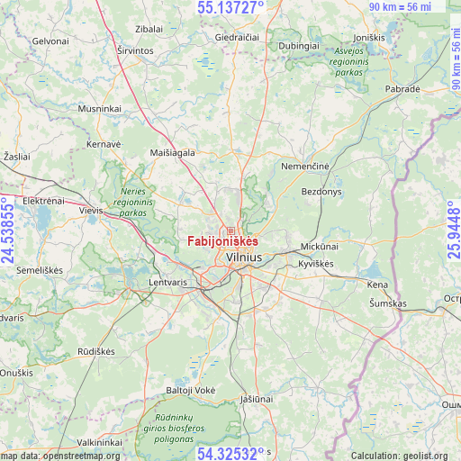
Fabijoniškės GPS coordinates[2]
54° 43' 59.988" North, 25° 14' 30.012" East
| Map corner | latitude | longitude |
|---|---|---|
| Upper-left | 55.13727°, | 24.53855° |
| Center: | 54.73333°, | 25.24167° |
| Lower-right: | 54.32532°, | 25.9448° |
| Map W x H: | 90.3×90.3 km | = 56.1×56.1mi |
| max Lat: | 56.36149° ⇑74.6% North |
| Fabijoniškės: | 54.73333° |
| min Lat: | ⇓25.4% South 54.01573° |
| min Long | Fabijoniškės | max Long |
| 20.99651° | 25.24167° | 26.43984° |
| W 84.3%⇐ | ⇒15.7% E |
Elevation
Elevation of Fabijoniškės is 184 m = 604 ft, and this is 93.3 m = 306 ft above average elevation for this country.
| Max E: |
204 m = 669 ft | 1.5% |
| Fabijoniškės | 184 m 604 ft | |
| Avg. | 90.7 m = 298 ft | |
Min E: |
-1 m = -3 ft | 98.5% |
See also: Lithuania elevation on elevation.city.
Geographical zone
Fabijoniškės is located in North temperate zone (between Tropic of Cancer and the Arctic Circle). Distance of this North polar circle is 1315.4 km =817.4 mi to North.| Distance of | km | miles | from Fabijoniškės |
|---|---|---|---|
| North Pole | 3921.3 | 2436.6 | to North |
| Arctic Circle | 1315.4 | 817.4 | to North |
| Tropic Cancer | 3479.9 | 2162.3 | to South |
| Equator | 6085.8 | 3781.5 | to South |


Nearby cities:
15 places around Fabijoniškės: (largest is in red/bold)
• Baltoji Vokė
15.1 km =9.4 mi,  191°
191°
• Grigiškės
11.6 km =7.2 mi,  241°
241°
• Justiniškės
2.4 km =1.5 mi,  220°
220°
• Lazdynai
7.6 km =4.7 mi,  197°
197°
• Lentvaris
15.8 km =9.8 mi,  230°
230°
• Naujamiestis
6.2 km =3.9 mi,  163°
163°
• Nemenčinė
19.4 km =12.1 mi,  48°
48°
• Pašilaičiai
1.5 km =0.9 mi,  274°
274°
• Pilaitė
5.3 km =3.3 mi, 224°
• Rasos
7.6 km =4.7 mi,  143°
143°
• Senieji Trakai
21.8 km =13.5 mi, 230°
• Skaidiškės
16.6 km =10.3 mi, 143°
• Vilkpėdė
7.1 km =4.4 mi,  176°
176°
• Vilnius
5.5 km =3.4 mi,  153°
153°
• Šeškinė
2.7 km =1.7 mi,  167°
167°
Sources, notices
• [Note1] Compared only with cities in Lithuania existing in our database
• [Src1] Map data: © OpenStreetMap contributors (CC-BY-SA)
• [Src2] Other city data from geonames.org with taken over terms of usage.
• [Src3] Geographical zone / Annual Mean Temperature by Robert A. Rohde @ Wikipedia
