Gostivar geodata
Gostivar is a seat of a first-order administrative division; located in North Macedonia in Europe/Skopje (GMT+2) time zone. With population of 50,974 people, there are 9 cities with bigger population in this country. Compared to other cities in North Macedonia, 56.9% of cities are located further ↓South; 92.3% of cities are located further →East and 52.2% of cities have higher elevation than Gostivar. Note1


Gostivar GPS coordinates[2]
41° 47' 45.636" North, 20° 54' 29.484" East
| Map corner | latitude | longitude |
|---|---|---|
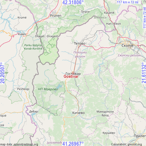
| Upper-left | 42.31806°, | 20.20507° |
| Center: | 41.79601°, | 20.90819° |
| Lower-right: | 41.26967°, | 21.61132° |
| Map W x H: | 116.6×116.6 km | = 72.5×72.5mi |
| max Lat: | 42.23276° ⇑43.1% North |
| Gostivar: | 41.79601° |
| min Lat: | ⇓56.9% South 40.87556° |
| min Long | Gostivar | max Long |
| 20.52421° | 20.90819° | 22.95624° |
| W 7.7%⇐ | ⇒92.3% E |
Elevation
Elevation of Gostivar is 535 m = 1755 ft, and this is 4.7 m = 15 ft below average elevation for this country.
| Max E: |
1382 m = 4534 ft | 52.2% |
| Avg. | 539.7 m = 1771 ft | |
| Gostivar | 535 m = 1755 ft | |
Min E: |
62 m = 203 ft | 47.8% |
See also: Gostivar elevation on elevation.city.
Geographical zone
Gostivar is located in North temperate zone (between Tropic of Cancer and the Arctic Circle). Distance of this Northern Tropic circle is 2041.4 km =1268.5 mi to South.| Distance of | km | miles | from Gostivar |
|---|---|---|---|
| North Pole | 5359.8 | 3330.4 | to North |
| Arctic Circle | 2753.9 | 1711.2 | to North |
| Tropic Cancer | 2041.4 | 1268.5 | to South |
| Equator | 4647.3 | 2887.7 | to South |


Nearby cities:
15 places around Gostivar: (largest is in red/bold)
• Bogovinje
14.2 km =8.8 mi,  1°
1°
• Cegrane
7.4 km =4.6 mi,  49°
49°
• Dobri Dol
7.8 km =4.8 mi,  348°
348°
• Dolna Banjica
1.1 km =0.7 mi,  188°
188°
• Forino
5.4 km =3.4 mi,  55°
55°
• Gradec
11.1 km =6.9 mi,  358°
358°
• Korito
9.9 km =6.2 mi,  83°
83°
• Mavrovi Anovi
16.3 km =10.1 mi,  230°
230°
• Miletino
15.3 km =9.5 mi,  35°
35°
• Negotino
9.3 km =5.8 mi, 347°
• Pirok
12.8 km =8 mi, 0°
• Srbinovo
10.9 km =6.8 mi,  157°
157°
• Strajane
11.3 km =7 mi,  136°
136°
• Vrapčište
4.7 km =2.9 mi,  336°
336°
• Vrutok
6.5 km =4 mi,  241°
241°
Sources, notices
• [Note1] Compared only with cities in North Macedonia existing in our database
• [Src1] Map data: © OpenStreetMap contributors (CC-BY-SA)
• [Src2] Other city data from geonames.org with taken over terms of usage.
• [Src3] Geographical zone / Annual Mean Temperature by Robert A. Rohde @ Wikipedia
