Gorno Strogomište geodata
Gorno Strogomište (Kichevo) is a populated place; located in North Macedonia in Europe/Skopje (GMT+2) time zone. With population of 915 people, there are 209 cities with bigger population in this country. Compared to other cities in North Macedonia, 53.5% of cities are located further ↑North; 87.5% of cities are located further →East and 81.1% of cities have lower elevation than Gorno Strogomište. Note1


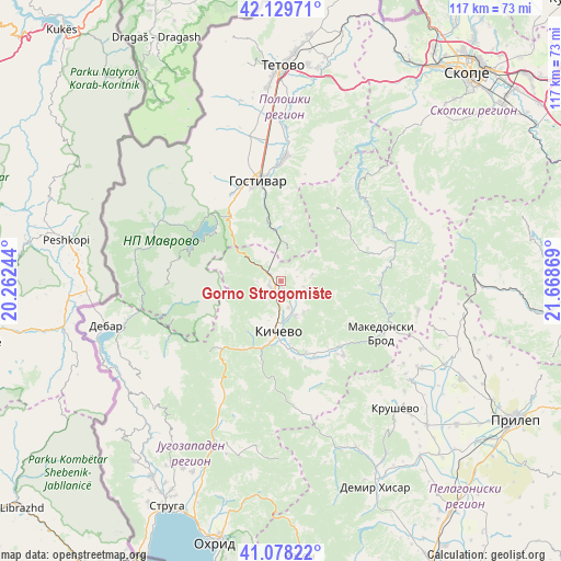
Gorno Strogomište GPS coordinates[2]
41° 36' 21.996" North, 20° 57' 56.016" East
| Map corner | latitude | longitude |
|---|---|---|
| Upper-left | 42.12971°, | 20.26244° |
| Center: | 41.60611°, | 20.96556° |
| Lower-right: | 41.07822°, | 21.66869° |
| Map W x H: | 116.9×116.9 km | = 72.6×72.6mi |
| max Lat: | 42.23276° ⇑53.5% North |
| Gorno Strogomište: | 41.60611° |
| min Lat: | ⇓46.5% South 40.87556° |
| min Long | Gorno Strogomi� | max Long |
| 20.52421° | 20.96556° | 22.95624° |
| W 12.5%⇐ | ⇒87.5% E |
Elevation
Elevation of Gorno Strogomište is 731 m = 2398 ft, and this is 191.3 m = 628 ft above average elevation for this country.
| Max E: |
1382 m = 4534 ft | 18.9% |
| Gorno Strogomište | 731 m 2398 ft | |
| Avg. | 539.7 m = 1771 ft | |
Min E: |
62 m = 203 ft | 81.1% |
See also: North Macedonia elevation on elevation.city.
Geographical zone
Gorno Strogomište is located in North temperate zone (between Tropic of Cancer and the Arctic Circle). Distance of this Northern Tropic circle is 2020.2 km =1255.3 mi to South.| Distance of | km | miles | from Gorno Strogomište |
|---|---|---|---|
| North Pole | 5380.9 | 3343.5 | to North |
| Arctic Circle | 2775 | 1724.3 | to North |
| Tropic Cancer | 2020.2 | 1255.3 | to South |
| Equator | 4626.2 | 2874.6 | to South |


Nearby cities:
15 places around Gorno Strogomište: (largest is in red/bold)
• Arangel
5 km =3.1 mi,  103°
103°
• Drugovo
13.9 km =8.6 mi,  193°
193°
• Gorni Dlapkin Dol
5.8 km =3.6 mi,  205°
205°
• Kičevo
10.4 km =6.5 mi,  183°
183°
• Lisičani
17.7 km =11 mi,  155°
155°
• Preglovo
20.2 km =12.6 mi,  140°
140°
• Samokov
17.3 km =10.7 mi,  60°
60°
• Srbica
5.8 km =3.6 mi,  111°
111°
• Srbinovo
11.1 km =6.9 mi,  357°
357°
• Strajane
13.2 km =8.2 mi,  13°
13°
• Strelci
8 km =5 mi, 155°
• Tuin
6.8 km =4.2 mi,  77°
77°
• Vraneštica
18.6 km =11.6 mi, 164°
• Zajas
2.3 km =1.4 mi,  273°
273°
• Šutovo
8.1 km =5 mi, 143°
Sources, notices
• [Note1] Compared only with cities in North Macedonia existing in our database
• [Src1] Map data: © OpenStreetMap contributors (CC-BY-SA)
• [Src2] Other city data from geonames.org with taken over terms of usage.
• [Src3] Geographical zone / Annual Mean Temperature by Robert A. Rohde @ Wikipedia
