Чучер - Сандево geodata
Чучер - Сандево (Chucher Sandevo) is a seat of a first-order administrative division; located in North Macedonia in Europe/Skopje (GMT+2) time zone. With population of 8,646 people, there are 57 cities with bigger population in this country. Compared to other cities in North Macedonia, 94.9% of cities are located further ↓South; 51.9% of cities are located further ←West and 52.9% of cities have higher elevation than Чучер - Сандево. Note1


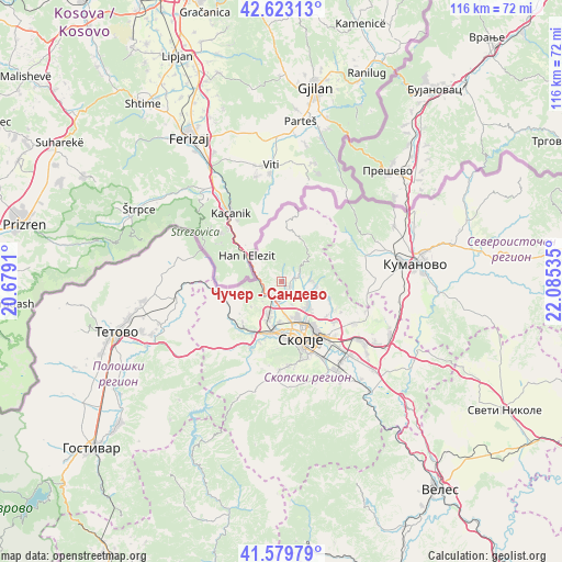
Чучер - Сандево GPS coordinates[2]
42° 6' 12.996" North, 21° 22' 55.992" East
| Map corner | latitude | longitude |
|---|---|---|
| Upper-left | 42.62313°, | 20.6791° |
| Center: | 42.10361°, | 21.38222° |
| Lower-right: | 41.57979°, | 22.08535° |
| Map W x H: | 116×116 km | = 72.1×72.1mi |
| max Lat: | 42.23276° ⇑5.1% North |
| Чучер - Сандево: | 42.10361° |
| min Lat: | ⇓94.9% South 40.87556° |
| min Long | Чучер - С | max Long |
| 20.52421° | 21.38222° | 22.95624° |
| W 51.9%⇐ | ⇒48.1% E |
Elevation
Elevation of Чучер - Сандево is 525 m = 1722 ft, and this is 14.7 m = 48 ft below average elevation for this country.
| Max E: |
1382 m = 4534 ft | 52.9% |
| Avg. | 539.7 m = 1771 ft | |
| Чучер - Сандево | 525 m = 1722 ft | |
Min E: |
62 m = 203 ft | 47.1% |
See also: North Macedonia elevation on elevation.city.
Geographical zone
Чучер - Сандево is located in North temperate zone (between Tropic of Cancer and the Arctic Circle). Distance of this Northern Tropic circle is 2075.6 km =1289.7 mi to South.| Distance of | km | miles | from Чучер - Сандево |
|---|---|---|---|
| North Pole | 5325.6 | 3309.2 | to North |
| Arctic Circle | 2719.7 | 1689.9 | to North |
| Tropic Cancer | 2075.6 | 1289.7 | to South |
| Equator | 4681.5 | 2908.9 | to South |


Nearby cities:
15 places around Чучер - Сандево: (largest is in red/bold)
• Butel
9.7 km =6 mi,  146°
146°
• Cresevo
12 km =7.5 mi,  119°
119°
• Gjorče Petro
10.9 km =6.8 mi,  192°
192°
• Grčec
13.5 km =8.4 mi,  198°
198°
• Kondovo
11.7 km =7.3 mi,  208°
208°
• Ljubin
12.9 km =8 mi, 207°
• Radishani
7.2 km =4.5 mi,  131°
131°
• Saraj
12.4 km =7.7 mi, 201°
• Skopje
12.6 km =7.8 mi,  161°
161°
• Čair
11 km =6.8 mi, 153°
• Šuto Orizare
7.9 km =4.9 mi, 153°
• Булачани
10.6 km =6.6 mi,  110°
110°
• Кучково
8.2 km =5.1 mi,  230°
230°
• Мирковци
2.2 km =1.4 mi, 117°
• Никиштане
5.6 km =3.5 mi,  223°
223°
Sources, notices
• [Note1] Compared only with cities in North Macedonia existing in our database
• [Src1] Map data: © OpenStreetMap contributors (CC-BY-SA)
• [Src2] Other city data from geonames.org with taken over terms of usage.
• [Src3] Geographical zone / Annual Mean Temperature by Robert A. Rohde @ Wikipedia
