Čaška geodata
Čaška (Chashka) is a seat of a first-order administrative division; located in North Macedonia in Europe/Skopje (GMT+2) time zone. With population of 2,878 people, there are 104 cities with bigger population in this country. Compared to other cities in North Macedonia, 50.5% of cities are located further ↑North; 72.7% of cities are located further ←West and 74.4% of cities have higher elevation than Čaška. Note1


Čaška GPS coordinates[2]
41° 39' 2.016" North, 21° 39' 43.992" East
| Map corner | latitude | longitude |
|---|---|---|
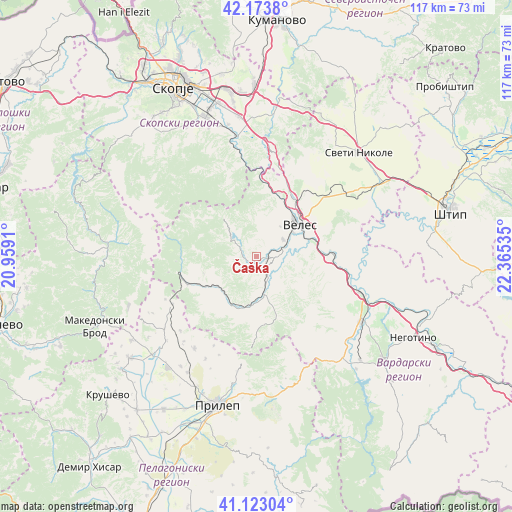
| Upper-left | 42.1738°, | 20.9591° |
| Center: | 41.65056°, | 21.66222° |
| Lower-right: | 41.12304°, | 22.36535° |
| Map W x H: | 116.8×116.8 km | = 72.6×72.6mi |
| max Lat: | 42.23276° ⇑50.5% North |
| Čaška: | 41.65056° |
| min Lat: | ⇓49.5% South 40.87556° |
| min Long | Čaška | max Long |
| 20.52421° | 21.66222° | 22.95624° |
| W 72.7%⇐ | ⇒27.3% E |
Elevation
Elevation of Čaška is 344 m = 1129 ft, and this is 195.7 m = 642 ft below average elevation for this country.
| Max E: |
1382 m = 4534 ft | 74.4% |
| Avg. | 539.7 m = 1771 ft | |
| Čaška | 344 m = 1129 ft | |
Min E: |
62 m = 203 ft | 25.6% |
See also: North Macedonia elevation on elevation.city.
Geographical zone
Čaška is located in North temperate zone (between Tropic of Cancer and the Arctic Circle). Distance of this Northern Tropic circle is 2025.2 km =1258.4 mi to South.| Distance of | km | miles | from Čaška |
|---|---|---|---|
| North Pole | 5376 | 3340.5 | to North |
| Arctic Circle | 2770.1 | 1721.3 | to North |
| Tropic Cancer | 2025.2 | 1258.4 | to South |
| Equator | 4631.1 | 2877.6 | to South |


Nearby cities:
15 places around Čaška: (largest is in red/bold)
• Bašino Selo
13.6 km =8.5 mi,  36°
36°
• Bogomila
17.1 km =10.6 mi,  248°
248°
• Buzalkovo
9.9 km =6.2 mi,  6°
6°
• Crnilište
24.6 km =15.3 mi,  237°
237°
• Dorfulija
23 km =14.3 mi,  56°
56°
• Gorno Orizari
7.2 km =4.5 mi, 56°
• Gradsko
24.7 km =15.3 mi,  109°
109°
• Karatmanovo
21.1 km =13.1 mi,  53°
53°
• Melnica
6.1 km =3.8 mi,  260°
260°
• Oreše
20.5 km =12.7 mi, 260°
• Prevalec
9.3 km =5.8 mi, 55°
• Veles
11.9 km =7.4 mi, 52°
• Viničani
20.3 km =12.6 mi, 105°
• Горно Јаболчиште
16.7 km =10.4 mi,  298°
298°
• Извор
11 km =6.8 mi,  164°
164°
Sources, notices
• [Note1] Compared only with cities in North Macedonia existing in our database
• [Src1] Map data: © OpenStreetMap contributors (CC-BY-SA)
• [Src2] Other city data from geonames.org with taken over terms of usage.
• [Src3] Geographical zone / Annual Mean Temperature by Robert A. Rohde @ Wikipedia
