Néma geodata
Néma (Hodh Ech Chargi) is a seat of a first-order administrative division; located in Mauritania in Africa/Nouakchott (GMT+0) time zone. With population of 60,000 people, there are 2 cities with bigger population in this country. Compared to other cities in Mauritania, 78.9% of cities are located further ↑North; 100% of cities are located further ←West and 84.2% of cities have lower elevation than Néma. Note1


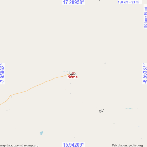
Néma GPS coordinates[2]
16° 37' 1.272" North, 7° 15' 23.364" West
| Map corner | latitude | longitude |
|---|---|---|
| Upper-left | 17.28958°, | -7.95962° |
| Center: | 16.61702°, | -7.25649° |
| Lower-right: | 15.94209°, | -6.55337° |
| Map W x H: | 149.8×149.8 km | = 93.1×93.1mi |
| max Lat: | 22.73542° ⇑78.9% North |
| Néma: | 16.61702° |
| min Lat: | ⇓21.1% South 15.15846° |
| min Long | Néma | max Long |
| -17.03842° | -7.25649° | -7.25649° |
| W 100%⇐ | ⇒0% E |
Elevation
Elevation of Néma is 266 m = 873 ft, and this is 139.9 m = 459 ft above average elevation for this country.
| Max E: |
500 m = 1640 ft | 15.8% |
| Néma | 266 m 873 ft | |
| Avg. | 126.1 m = 414 ft | |
Min E: |
1 m = 3 ft | 84.2% |
See also: Néma elevation on elevation.city.
Geographical zone
Néma is located in North Torrid zone (between Equator and Tropic of Cancer). Distance of this Northern Tropic circle is 758.3 km =471.2 mi to North.| Distance of | km | miles | from Néma |
|---|---|---|---|
| North Pole | 8159.4 | 5070 | to North |
| Arctic Circle | 5553.5 | 3450.8 | to North |
| Tropic Cancer | 758.3 | 471.2 | to North |
| Equator | 1847.6 | 1148 | to South |


 271°
271°Sources, notices
• [Note1] Compared only with cities in Mauritania existing in our database
• [Src1] Map data: © OpenStreetMap contributors (CC-BY-SA)
• [Src2] Other city data from geonames.org with taken over terms of usage.
• [Src3] Geographical zone / Annual Mean Temperature by Robert A. Rohde @ Wikipedia
