Tlacotepec geodata
Tlacotepec (Morelos) is a populated place; located in Mexico in America/Mexico_City (GMT-6) time zone. With population of 5,087 people, there are 1819 cities with bigger population in this country. Compared to other cities in Mexico, 68.5% of cities are located further ↑North; 54.5% of cities are located further ←West and 62.8% of cities have lower elevation than Tlacotepec. Note1


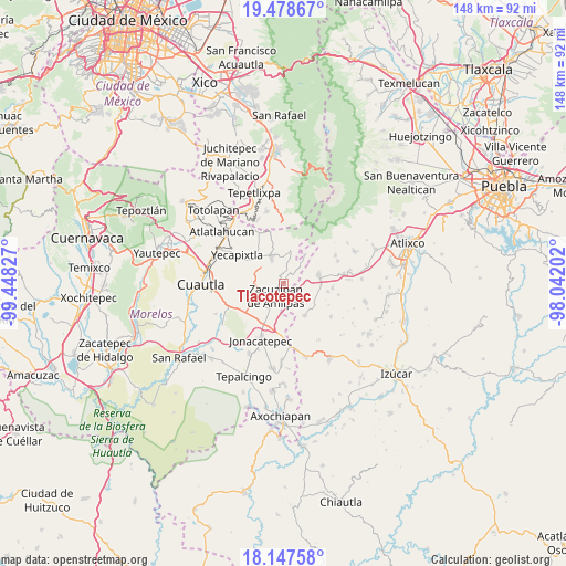
Tlacotepec GPS coordinates[2]
18° 48' 51.984" North, 98° 44' 42.504" West
| Map corner | latitude | longitude |
|---|---|---|
| Upper-left | 19.47867°, | -99.44827° |
| Center: | 18.81444°, | -98.74514° |
| Lower-right: | 18.14758°, | -98.04202° |
| Map W x H: | 148×148 km | = 92×92mi |
| max Lat: | 32.7° ⇑68.5% North |
| Tlacotepec: | 18.81444° |
| min Lat: | ⇓31.5% South 14.53588° |
| min Long | Tlacotepec | max Long |
| -117.105° | -98.74514° | -86.73105° |
| W 54.5%⇐ | ⇒45.5% E |
Elevation
Elevation of Tlacotepec is 1775 m = 5823 ft, and this is 521.3 m = 1710 ft above average elevation for this country.
| Max E: |
3497 m = 11473 ft | 37.2% |
| Tlacotepec | 1775 m 5823 ft | |
| Avg. | 1253.7 m = 4113 ft | |
Min E: |
-1 m = -3 ft | 62.8% |
See also: Mexico elevation on elevation.city.
Geographical zone
Tlacotepec is located in North Torrid zone (between Equator and Tropic of Cancer). Distance of this Northern Tropic circle is 513.9 km =319.3 mi to North.| Distance of | km | miles | from Tlacotepec |
|---|---|---|---|
| North Pole | 7915.1 | 4918.2 | to North |
| Arctic Circle | 5309.2 | 3299 | to North |
| Tropic Cancer | 513.9 | 319.3 | to North |
| Equator | 2092 | 1299.9 | to South |


Nearby cities:
15 places around Tlacotepec: (largest is in red/bold)
• Acteopan
6.5 km =4 mi,  149°
149°
• Amilcingo
8.4 km =5.2 mi,  198°
198°
• Cohuecán
4.4 km =2.7 mi,  144°
144°
• Huazulco
7.5 km =4.7 mi, 204°
• Metepec
7.2 km =4.5 mi,  358°
358°
• Ocuituco
7.6 km =4.7 mi,  337°
337°
• Popotlán (Barrio Santo Tomás)
5.9 km =3.7 mi, 201°
• San Antonio Alpanocan
7.9 km =4.9 mi,  27°
27°
• San Felipe Cuapexco
4.3 km =2.7 mi,  80°
80°
• San Felipe Toctla
7.6 km =4.7 mi, 140°
• San Francisco Tepango
5.2 km =3.2 mi,  61°
61°
• Tecajec
7.6 km =4.7 mi,  256°
256°
• Temoac
5.8 km =3.6 mi,  215°
215°
• Tetela del Volcán
8.9 km =5.5 mi,  10°
10°
• Zacualpan de Amilpas
4 km =2.5 mi,  212°
212°
Sources, notices
• [Note1] Compared only with cities in Mexico existing in our database
• [Src1] Map data: © OpenStreetMap contributors (CC-BY-SA)
• [Src2] Other city data from geonames.org with taken over terms of usage.
• [Src3] Geographical zone / Annual Mean Temperature by Robert A. Rohde @ Wikipedia
