Santa Isabel geodata
Santa Isabel (State of Mexico) is a populated place; located in Mexico in America/Mexico_City (GMT-6) time zone. With population of 535 people, there are 15842 cities with bigger population in this country. Compared to other cities in Mexico, 53.4% of cities are located further ↑North; 59% of cities are located further →East and 96.5% of cities have lower elevation than Santa Isabel. Note1


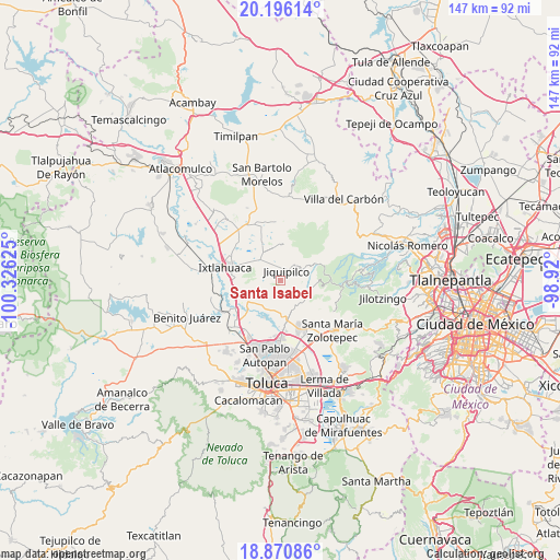
Santa Isabel GPS coordinates[2]
19° 32' 5.496" North, 99° 37' 23.232" West
| Map corner | latitude | longitude |
|---|---|---|
| Upper-left | 20.19614°, | -100.32625° |
| Center: | 19.53486°, | -99.62312° |
| Lower-right: | 18.87086°, | -98.92° |
| Map W x H: | 147.4×147.4 km | = 91.6×91.6mi |
| max Lat: | 32.7° ⇑53.4% North |
| Santa Isabel: | 19.53486° |
| min Lat: | ⇓46.6% South 14.53588° |
| min Long | Santa Isabel | max Long |
| -117.105° | -99.62312° | -86.73105° |
| W 41%⇐ | ⇒59% E |
Elevation
Elevation of Santa Isabel is 2653 m = 8704 ft, and this is 1399.3 m = 4591 ft above average elevation for this country.
| Max E: |
3497 m = 11473 ft | 3.5% |
| Santa Isabel | 2653 m 8704 ft | |
| Avg. | 1253.7 m = 4113 ft | |
Min E: |
-1 m = -3 ft | 96.5% |
See also: Mexico elevation on elevation.city.
Geographical zone
Santa Isabel is located in North Torrid zone (between Equator and Tropic of Cancer). Distance of this Northern Tropic circle is 433.8 km =269.6 mi to North.| Distance of | km | miles | from Santa Isabel |
|---|---|---|---|
| North Pole | 7835 | 4868.4 | to North |
| Arctic Circle | 5229.1 | 3249.2 | to North |
| Tropic Cancer | 433.8 | 269.6 | to North |
| Equator | 2172.1 | 1349.7 | to South |


Nearby cities:
15 places around Santa Isabel: (largest is in red/bold)
• Cerrito del Panal
4.2 km =2.6 mi,  163°
163°
• Ejido de Santa María Nativitas
4.4 km =2.7 mi,  340°
340°
• El Jaral
1.7 km =1.1 mi,  194°
194°
• Jiquipilco
2.9 km =1.8 mi,  32°
32°
• Loma del Madroño
2.3 km =1.4 mi,  268°
268°
• Manzana Primera Parte Alta
4.4 km =2.7 mi,  48°
48°
• Manzana Primera la Capilla
2.2 km =1.4 mi, 50°
• Manzana Quinta (La Cañada)
2.3 km =1.4 mi,  69°
69°
• Manzana Segunda
4.7 km =2.9 mi,  40°
40°
• Manzana Sexta Parte Alta
4.1 km =2.5 mi,  106°
106°
• Manzana Sexta Parte Baja
2.6 km =1.6 mi,  90°
90°
• Manzana Sexta Parte Centro
2 km =1.2 mi, 113°
• Manzana Tercera (Bodo)
4.6 km =2.9 mi, 28°
• Moxteje
4.1 km =2.5 mi,  345°
345°
• Portezuelo
3.9 km =2.4 mi,  256°
256°
Sources, notices
• [Note1] Compared only with cities in Mexico existing in our database
• [Src1] Map data: © OpenStreetMap contributors (CC-BY-SA)
• [Src2] Other city data from geonames.org with taken over terms of usage.
• [Src3] Geographical zone / Annual Mean Temperature by Robert A. Rohde @ Wikipedia
