San Miguel Almoloyan geodata
San Miguel Almoloyan (State of Mexico) is a populated place; located in Mexico in America/Mexico_City (GMT-6) time zone. With population of 3,165 people, there are 2854 cities with bigger population in this country. Compared to other cities in Mexico, 57.5% of cities are located further ↑North; 61.4% of cities are located further →East and 96.2% of cities have lower elevation than San Miguel Almoloyan. Note1


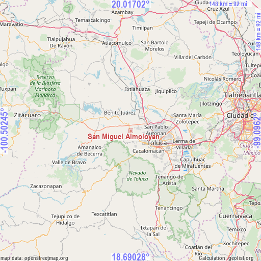
San Miguel Almoloyan GPS coordinates[2]
19° 21' 18" North, 99° 47' 57.552" West
| Map corner | latitude | longitude |
|---|---|---|
| Upper-left | 20.01702°, | -100.50245° |
| Center: | 19.355°, | -99.79932° |
| Lower-right: | 18.69028°, | -99.0962° |
| Map W x H: | 147.5×147.5 km | = 91.7×91.7mi |
| max Lat: | 32.7° ⇑57.5% North |
| San Miguel Almoloyan: | 19.355° |
| min Lat: | ⇓42.5% South 14.53588° |
| min Long | San Miguel Almo | max Long |
| -117.105° | -99.79932° | -86.73105° |
| W 38.6%⇐ | ⇒61.4% E |
Elevation
Elevation of San Miguel Almoloyan is 2636 m = 8648 ft, and this is 1382.3 m = 4535 ft above average elevation for this country.
| Max E: |
3497 m = 11473 ft | 3.8% |
| San Miguel Almoloyan | 2636 m 8648 ft | |
| Avg. | 1253.7 m = 4113 ft | |
Min E: |
-1 m = -3 ft | 96.2% |
See also: Mexico elevation on elevation.city.
Geographical zone
San Miguel Almoloyan is located in North Torrid zone (between Equator and Tropic of Cancer). Distance of this Northern Tropic circle is 453.8 km =282 mi to North.| Distance of | km | miles | from San Miguel Almoloyan |
|---|---|---|---|
| North Pole | 7855 | 4880.9 | to North |
| Arctic Circle | 5249.1 | 3261.6 | to North |
| Tropic Cancer | 453.8 | 282 | to North |
| Equator | 2152.1 | 1337.3 | to South |


Nearby cities:
15 places around San Miguel Almoloyan: (largest is in red/bold)
• Cañada de Guadarrama
4.8 km =3 mi,  167°
167°
• Colonia la Navidad
4.1 km =2.5 mi,  81°
81°
• Conjunto Habitacional Ecológico SUTEYM
2.7 km =1.7 mi,  54°
54°
• Ejido Tres Barrancas
2.2 km =1.4 mi, 169°
• El Plan
2.2 km =1.4 mi,  356°
356°
• El Tepetatal
3.2 km =2 mi,  108°
108°
• La Cabecera
5.4 km =3.4 mi,  88°
88°
• Loma de San Miguel
1.7 km =1.1 mi,  151°
151°
• Paredón Ejido
5 km =3.1 mi,  306°
306°
• San Bartolo del Llano (San Isidro)
6.3 km =3.9 mi,  208°
208°
• San Isidro (El Reservado)
5.8 km =3.6 mi,  158°
158°
• San Mateo Tlalchichilpan
4.6 km =2.9 mi, 107°
• San Pedro de la Hortaliza (Ejido Almoloyán)
4.2 km =2.6 mi,  332°
332°
• Santa Juana Primera Sección
6.3 km =3.9 mi, 51°
• Villa de Almoloya de Juárez
4.6 km =2.9 mi,  69°
69°
Sources, notices
• [Note1] Compared only with cities in Mexico existing in our database
• [Src1] Map data: © OpenStreetMap contributors (CC-BY-SA)
• [Src2] Other city data from geonames.org with taken over terms of usage.
• [Src3] Geographical zone / Annual Mean Temperature by Robert A. Rohde @ Wikipedia
