San Lorenzo Cuauhtenco geodata
San Lorenzo Cuauhtenco (Morelos) is a populated place; located in Mexico in America/Mexico_City (GMT-6) time zone. With population of 3,220 people, there are 2813 cities with bigger population in this country. Compared to other cities in Mexico, 61.3% of cities are located further ↑North; 59.1% of cities are located further →East and 98% of cities have lower elevation than San Lorenzo Cuauhtenco. Note1


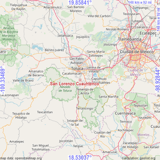
San Lorenzo Cuauhtenco GPS coordinates[2]
19° 11' 44.628" North, 99° 37' 53.616" West
| Map corner | latitude | longitude |
|---|---|---|
| Upper-left | 19.85841°, | -100.33469° |
| Center: | 19.19573°, | -99.63156° |
| Lower-right: | 18.53037°, | -98.92844° |
| Map W x H: | 147.7×147.7 km | = 91.8×91.8mi |
| max Lat: | 32.7° ⇑61.3% North |
| San Lorenzo Cuauhtenco: | 19.19573° |
| min Lat: | ⇓38.7% South 14.53588° |
| min Long | San Lorenzo Cua | max Long |
| -117.105° | -99.63156° | -86.73105° |
| W 40.9%⇐ | ⇒59.1% E |
Elevation
Elevation of San Lorenzo Cuauhtenco is 2743 m = 8999 ft, and this is 1489.3 m = 4886 ft above average elevation for this country.
| Max E: |
3497 m = 11473 ft | 2% |
| San Lorenzo Cuauhtenco | 2743 m 8999 ft | |
| Avg. | 1253.7 m = 4113 ft | |
Min E: |
-1 m = -3 ft | 98% |
See also: Mexico elevation on elevation.city.
Geographical zone
San Lorenzo Cuauhtenco is located in North Torrid zone (between Equator and Tropic of Cancer). Distance of this Northern Tropic circle is 471.6 km =293 mi to North.| Distance of | km | miles | from San Lorenzo Cuauhtenco |
|---|---|---|---|
| North Pole | 7872.7 | 4891.9 | to North |
| Arctic Circle | 5266.8 | 3272.6 | to North |
| Tropic Cancer | 471.6 | 293 | to North |
| Equator | 2134.4 | 1326.3 | to South |


Nearby cities:
15 places around San Lorenzo Cuauhtenco: (largest is in red/bold)
• Barrio Santiaguito
3.8 km =2.4 mi,  12°
12°
• Barrio la Venta
5.1 km =3.2 mi,  354°
354°
• Calimaya
3.9 km =2.4 mi,  158°
158°
• Colonia Loma Bonita
5 km =3.1 mi,  324°
324°
• Colonia el Tarimoro
1.9 km =1.2 mi,  335°
335°
• Colonia la Joya
4.5 km =2.8 mi, 322°
• El Calvario
4.8 km =3 mi,  170°
170°
• San Andrés Ocotlán
4.8 km =3 mi,  93°
93°
• San Bartolomé Tlaltelulco
3.5 km =2.2 mi,  3°
3°
• San Felipe Tlalmimilolpan
5 km =3.1 mi, 347°
• San Juan Tilapa
4 km =2.5 mi,  312°
312°
• San Marcos de la Cruz
2.6 km =1.6 mi,  247°
247°
• Santa María Magdalena Ocotitlán
4.7 km =2.9 mi, 9°
• Santa María Nativitas
1.8 km =1.1 mi, 7°
• Villas del Campo
2.7 km =1.7 mi,  130°
130°
Sources, notices
• [Note1] Compared only with cities in Mexico existing in our database
• [Src1] Map data: © OpenStreetMap contributors (CC-BY-SA)
• [Src2] Other city data from geonames.org with taken over terms of usage.
• [Src3] Geographical zone / Annual Mean Temperature by Robert A. Rohde @ Wikipedia
