Nueva Reforma geodata
Nueva Reforma (Chiapas) is a populated place; located in Mexico in America/Mexico_City (GMT-6) time zone. With population of 523 people, there are 16139 cities with bigger population in this country. Compared to other cities in Mexico, 96.4% of cities are located further ↑North; 97.1% of cities are located further ←West and 76.9% of cities have higher elevation than Nueva Reforma. Note1


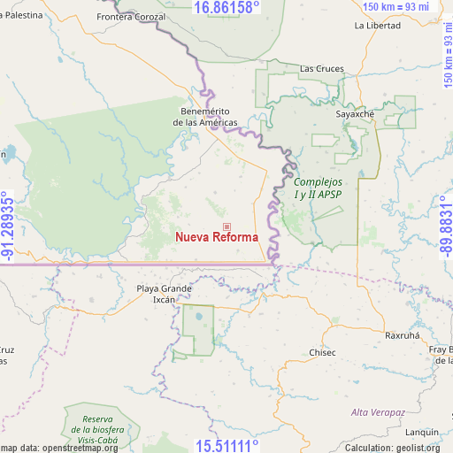
Nueva Reforma GPS coordinates[2]
16° 11' 15" North, 90° 35' 10.392" West
| Map corner | latitude | longitude |
|---|---|---|
| Upper-left | 16.86158°, | -91.28935° |
| Center: | 16.1875°, | -90.58622° |
| Lower-right: | 15.51111°, | -89.8831° |
| Map W x H: | 150.2×150.2 km | = 93.3×93.3mi |
| max Lat: | 32.7° ⇑96.4% North |
| Nueva Reforma: | 16.1875° |
| min Lat: | ⇓3.6% South 14.53588° |
| min Long | Nueva Reforma | max Long |
| -117.105° | -90.58622° | -86.73105° |
| W 97.1%⇐ | ⇒2.9% E |
Elevation
Elevation of Nueva Reforma is 157 m = 515 ft, and this is 1096.7 m = 3598 ft below average elevation for this country.
| Max E: |
3497 m = 11473 ft | 76.9% |
| Avg. | 1253.7 m = 4113 ft | |
| Nueva Reforma | 157 m = 515 ft | |
Min E: |
-1 m = -3 ft | 23.1% |
See also: Mexico elevation on elevation.city.
Geographical zone
Nueva Reforma is located in North Torrid zone (between Equator and Tropic of Cancer). Distance of this Northern Tropic circle is 806 km =500.8 mi to North.| Distance of | km | miles | from Nueva Reforma |
|---|---|---|---|
| North Pole | 8207.2 | 5099.7 | to North |
| Arctic Circle | 5601.3 | 3480.5 | to North |
| Tropic Cancer | 806 | 500.8 | to North |
| Equator | 1799.9 | 1118.4 | to South |


Nearby cities:
15 places around Nueva Reforma: (largest is in red/bold)
• Arroyo Delicias
8.7 km =5.4 mi,  154°
154°
• Benemérito de las Américas
37.2 km =23.1 mi,  348°
348°
• Benito Juárez
17.1 km =10.6 mi,  15°
15°
• El Ixcán
55.3 km =34.4 mi,  258°
258°
• Emiliano Zapata
11.9 km =7.4 mi,  341°
341°
• Flor de Cacao
15.8 km =9.8 mi,  114°
114°
• La Nueva Unión
22.9 km =14.2 mi,  240°
240°
• Nueva Sabanilla
68.4 km =42.5 mi,  277°
277°
• Nuevo Chihuahua
11.6 km =7.2 mi,  49°
49°
• Nuevo Orizaba
12.7 km =7.9 mi,  203°
203°
• Nuevo Rodulfo Figueroa
72.2 km =44.9 mi,  272°
272°
• Nuevo Veracruz
15.2 km =9.4 mi,  222°
222°
• Quiringüicharo
29.6 km =18.4 mi,  333°
333°
• Tierra y Libertad
12.5 km =7.8 mi, 272°
• Zamora Pico de Oro
25 km =15.5 mi,  310°
310°
Sources, notices
• [Note1] Compared only with cities in Mexico existing in our database
• [Src1] Map data: © OpenStreetMap contributors (CC-BY-SA)
• [Src2] Other city data from geonames.org with taken over terms of usage.
• [Src3] Geographical zone / Annual Mean Temperature by Robert A. Rohde @ Wikipedia
