La Ciénega geodata
La Ciénega (State of Mexico) is a populated place; located in Mexico in America/Mexico_City (GMT-6) time zone. With population of 583 people, there are 14713 cities with bigger population in this country. Compared to other cities in Mexico, 64.8% of cities are located further ↑North; 56.1% of cities are located further →East and 89% of cities have lower elevation than La Ciénega. Note1


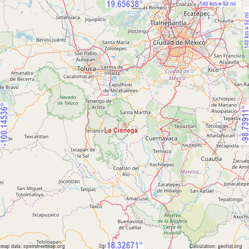
La Ciénega GPS coordinates[2]
18° 59' 34.332" North, 99° 26' 32.028" West
| Map corner | latitude | longitude |
|---|---|---|
| Upper-left | 19.65638°, | -100.14536° |
| Center: | 18.99287°, | -99.44223° |
| Lower-right: | 18.32671°, | -98.73911° |
| Map W x H: | 147.8×147.8 km | = 91.8×91.8mi |
| max Lat: | 32.7° ⇑64.8% North |
| La Ciénega: | 18.99287° |
| min Lat: | ⇓35.2% South 14.53588° |
| min Long | La Ciénega | max Long |
| -117.105° | -99.44223° | -86.73105° |
| W 43.9%⇐ | ⇒56.1% E |
Elevation
Elevation of La Ciénega is 2374 m = 7789 ft, and this is 1120.3 m = 3676 ft above average elevation for this country.
| Max E: |
3497 m = 11473 ft | 11% |
| La Ciénega | 2374 m 7789 ft | |
| Avg. | 1253.7 m = 4113 ft | |
Min E: |
-1 m = -3 ft | 89% |
See also: Mexico elevation on elevation.city.
Geographical zone
La Ciénega is located in North Torrid zone (between Equator and Tropic of Cancer). Distance of this Northern Tropic circle is 494.1 km =307 mi to North.| Distance of | km | miles | from La Ciénega |
|---|---|---|---|
| North Pole | 7895.3 | 4905.9 | to North |
| Arctic Circle | 5289.4 | 3286.7 | to North |
| Tropic Cancer | 494.1 | 307 | to North |
| Equator | 2111.8 | 1312.2 | to South |


Nearby cities:
15 places around La Ciénega: (largest is in red/bold)
• Chalmita
6.8 km =4.2 mi,  162°
162°
• Cinco Caminos
2.1 km =1.3 mi,  74°
74°
• Colonia Doctor Gustavo Baz
5.3 km =3.3 mi,  64°
64°
• El Picacho (San Antonio el Picacho)
4 km =2.5 mi,  314°
314°
• La Cañada
5.7 km =3.5 mi, 162°
• Lomas de Teocaltzingo (Loma de Tecalzingo)
6.2 km =3.9 mi,  77°
77°
• Ocuilan de Arteaga
2.9 km =1.8 mi,  125°
125°
• Reforma Agraria (El Pedregal)
0.6 km =0.4 mi, 69°
• San Juan Atzingo
6.3 km =3.9 mi, 72°
• San Nicolás
5.9 km =3.7 mi,  248°
248°
• San Sebastián
4.4 km =2.7 mi, 251°
• San Simón el Alto
6.4 km =4 mi,  273°
273°
• Santa Ana
3.1 km =1.9 mi,  101°
101°
• Santa Mónica
2 km =1.2 mi,  89°
89°
• Tepetzingo (Tepezingo)
3.3 km =2.1 mi, 84°
Sources, notices
• [Note1] Compared only with cities in Mexico existing in our database
• [Src1] Map data: © OpenStreetMap contributors (CC-BY-SA)
• [Src2] Other city data from geonames.org with taken over terms of usage.
• [Src3] Geographical zone / Annual Mean Temperature by Robert A. Rohde @ Wikipedia
