San Miguel Atepoxco geodata
San Miguel Atepoxco (Morelos) is a populated place; located in Mexico in America/Mexico_City (GMT-6) time zone. With population of 1,231 people, there are 7050 cities with bigger population in this country. Compared to other cities in Mexico, 51.4% of cities are located further ↓South; 54.5% of cities are located further ←West and 90.2% of cities have lower elevation than San Miguel Atepoxco. Note1


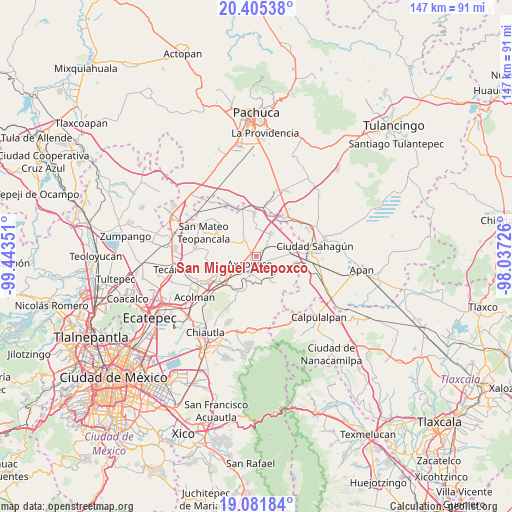
San Miguel Atepoxco GPS coordinates[2]
19° 44' 41.928" North, 98° 44' 25.368" West
| Map corner | latitude | longitude |
|---|---|---|
| Upper-left | 20.40538°, | -99.44351° |
| Center: | 19.74498°, | -98.74038° |
| Lower-right: | 19.08184°, | -98.03726° |
| Map W x H: | 147.2×147.2 km | = 91.5×91.5mi |
| max Lat: | 32.7° ⇑48.6% North |
| San Miguel Atepoxco: | 19.74498° |
| min Lat: | ⇓51.4% South 14.53588° |
| min Long | San Miguel Atep | max Long |
| -117.105° | -98.74038° | -86.73105° |
| W 54.5%⇐ | ⇒45.5% E |
Elevation
Elevation of San Miguel Atepoxco is 2415 m = 7923 ft, and this is 1161.3 m = 3810 ft above average elevation for this country.
| Max E: |
3497 m = 11473 ft | 9.8% |
| San Miguel Atepoxco | 2415 m 7923 ft | |
| Avg. | 1253.7 m = 4113 ft | |
Min E: |
-1 m = -3 ft | 90.2% |
See also: Mexico elevation on elevation.city.
Geographical zone
San Miguel Atepoxco is located in North Torrid zone (between Equator and Tropic of Cancer). Distance of this Northern Tropic circle is 410.5 km =255.1 mi to North.| Distance of | km | miles | from San Miguel Atepoxco |
|---|---|---|---|
| North Pole | 7811.6 | 4853.9 | to North |
| Arctic Circle | 5205.7 | 3234.7 | to North |
| Tropic Cancer | 410.5 | 255.1 | to North |
| Equator | 2195.4 | 1364.2 | to South |


Nearby cities:
15 places around San Miguel Atepoxco: (largest is in red/bold)
• Atla (Tecuautitlán Atla)
5.4 km =3.4 mi,  85°
85°
• Axapusco
3 km =1.9 mi,  220°
220°
• Barrio San Antonio
1.9 km =1.2 mi,  239°
239°
• Barrio San Bartolo Alto
1.8 km =1.1 mi,  197°
197°
• Colonia los Remedios
5.4 km =3.4 mi,  257°
257°
• Cuautlacingo
7.3 km =4.5 mi, 218°
• Nopaltepec
4.8 km =3 mi,  40°
40°
• Otumba
5.3 km =3.3 mi, 198°
• San Martín Ahuatepec
7.2 km =4.5 mi,  169°
169°
• San Pablo Ixquitlán
6.4 km =4 mi,  231°
231°
• San Pablo Xúchil
7.4 km =4.6 mi,  339°
339°
• Santiago Tolman
5.5 km =3.4 mi,  249°
249°
• Santo Domingo Aztacameca
5.1 km =3.2 mi,  324°
324°
• Tlalmimilolpan
7.5 km =4.7 mi,  193°
193°
• Tlamapa
1.8 km =1.1 mi, 258°
Sources, notices
• [Note1] Compared only with cities in Mexico existing in our database
• [Src1] Map data: © OpenStreetMap contributors (CC-BY-SA)
• [Src2] Other city data from geonames.org with taken over terms of usage.
• [Src3] Geographical zone / Annual Mean Temperature by Robert A. Rohde @ Wikipedia
