San Pedro del Rosal geodata
San Pedro del Rosal (State of Mexico) is a populated place; located in Mexico in America/Mexico_City (GMT-6) time zone. With population of 4,277 people, there are 2145 cities with bigger population in this country. Compared to other cities in Mexico, 52.2% of cities are located further ↓South; 61.6% of cities are located further →East and 93.9% of cities have lower elevation than San Pedro del Rosal. Note1


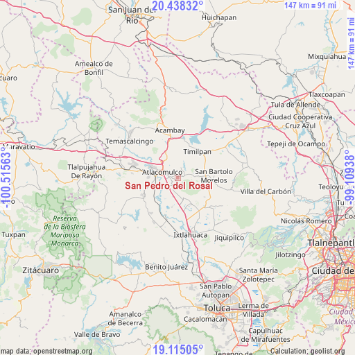
San Pedro del Rosal GPS coordinates[2]
19° 46' 41.016" North, 99° 48' 45" West
| Map corner | latitude | longitude |
|---|---|---|
| Upper-left | 20.43832°, | -100.51563° |
| Center: | 19.77806°, | -99.8125° |
| Lower-right: | 19.11505°, | -99.10938° |
| Map W x H: | 147.1×147.1 km | = 91.4×91.4mi |
| max Lat: | 32.7° ⇑47.8% North |
| San Pedro del Rosal: | 19.77806° |
| min Lat: | ⇓52.2% South 14.53588° |
| min Long | San Pedro del R | max Long |
| -117.105° | -99.8125° | -86.73105° |
| W 38.4%⇐ | ⇒61.6% E |
Elevation
Elevation of San Pedro del Rosal is 2570 m = 8432 ft, and this is 1316.3 m = 4319 ft above average elevation for this country.
| Max E: |
3497 m = 11473 ft | 6.1% |
| San Pedro del Rosal | 2570 m 8432 ft | |
| Avg. | 1253.7 m = 4113 ft | |
Min E: |
-1 m = -3 ft | 93.9% |
See also: Mexico elevation on elevation.city.
Geographical zone
San Pedro del Rosal is located in North Torrid zone (between Equator and Tropic of Cancer). Distance of this Northern Tropic circle is 406.8 km =252.8 mi to North.| Distance of | km | miles | from San Pedro del Rosal |
|---|---|---|---|
| North Pole | 7807.9 | 4851.6 | to North |
| Arctic Circle | 5202.1 | 3232.4 | to North |
| Tropic Cancer | 406.8 | 252.8 | to North |
| Equator | 2199.1 | 1366.5 | to South |


Nearby cities:
15 places around San Pedro del Rosal: (largest is in red/bold)
• Atlacomulco de Fabela
6.9 km =4.3 mi,  289°
289°
• Dolores la Joya (La Joya)
4.5 km =2.8 mi,  332°
332°
• El Rincón de la Candelaria
3.5 km =2.2 mi, 292°
• La Loma de Endare
5.3 km =3.3 mi,  194°
194°
• Ojo de Agua
6.3 km =3.9 mi,  209°
209°
• San Antonio Enchisi
2.6 km =1.6 mi, 189°
• San Felipe Pueblo Nuevo
5.8 km =3.6 mi,  101°
101°
• San Francisco Chalchihuapan
1.3 km =0.8 mi,  226°
226°
• San Ignacio de Loyola
4.9 km =3 mi,  321°
321°
• San José del Tunal
3.2 km =2 mi,  295°
295°
• San Luis Boro
6 km =3.7 mi,  310°
310°
• San Pablo Atotonilco
2.3 km =1.4 mi, 331°
• Santa María Endare
5.8 km =3.6 mi,  183°
183°
• Santiago Acutzilapan
5 km =3.1 mi,  79°
79°
• Tecoac (Santa María Nativitas)
4.4 km =2.7 mi, 286°
Sources, notices
• [Note1] Compared only with cities in Mexico existing in our database
• [Src1] Map data: © OpenStreetMap contributors (CC-BY-SA)
• [Src2] Other city data from geonames.org with taken over terms of usage.
• [Src3] Geographical zone / Annual Mean Temperature by Robert A. Rohde @ Wikipedia
