Poblado Puente Treviño geodata
Poblado Puente Treviño (Baja California) is a populated place; located in Mexico in America/Tijuana (GMT-7) time zone. With population of 568 people, there are 15043 cities with bigger population in this country. Compared to other cities in Mexico, 99.9% of cities are located further ↓South; 99.2% of cities are located further →East and 91.2% of cities have higher elevation than Poblado Puente Treviño. Note1


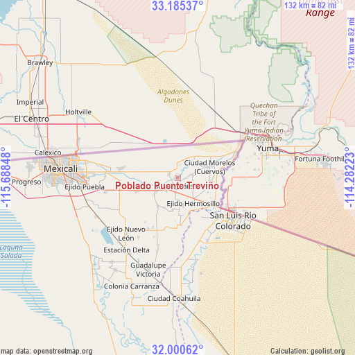
Poblado Puente Treviño GPS coordinates[2]
32° 35' 41.82" North, 114° 59' 7.26" West
| Map corner | latitude | longitude |
|---|---|---|
| Upper-left | 33.18537°, | -115.68848° |
| Center: | 32.59495°, | -114.98535° |
| Lower-right: | 32.00062°, | -114.28223° |
| Map W x H: | 131.7×131.7 km | = 81.8×81.8mi |
| max Lat: | 32.7° ⇑0.1% North |
| Poblado Puente Treviño: | 32.59495° |
| min Lat: | ⇓99.9% South 14.53588° |
| min Long | Poblado Puente | max Long |
| -117.105° | -114.98535° | -86.73105° |
| W 0.8%⇐ | ⇒99.2% E |
Elevation
Elevation of Poblado Puente Treviño is 21 m = 69 ft, and this is 1232.7 m = 4044 ft below average elevation for this country.
| Max E: |
3497 m = 11473 ft | 91.2% |
| Avg. | 1253.7 m = 4113 ft | |
| Poblado Puente Treviño | 21 m = 69 ft | |
Min E: |
-1 m = -3 ft | 8.8% |
See also: Mexico elevation on elevation.city.
Geographical zone
Poblado Puente Treviño is located in North temperate zone (between Tropic of Cancer and the Arctic Circle). Distance of this Northern Tropic circle is 1018.3 km =632.7 mi to South.| Distance of | km | miles | from Poblado Puente Treviño |
|---|---|---|---|
| North Pole | 6382.8 | 3966.1 | to North |
| Arctic Circle | 3777 | 2346.9 | to North |
| Tropic Cancer | 1018.3 | 632.7 | to South |
| Equator | 3624.2 | 2252 | to South |


Nearby cities:
15 places around Poblado Puente Treviño: (largest is in red/bold)
• Benito Juárez
3.1 km =1.9 mi,  195°
195°
• Ejido Chiapas 1
10.7 km =6.6 mi,  168°
168°
• Ejido Distrito Federal
12.2 km =7.6 mi, 203°
• Ejido Guadalajara
12.5 km =7.8 mi,  115°
115°
• Ejido Jiquilpan
12.7 km =7.9 mi,  215°
215°
• Ejido Lázaro Cárdenas
3.6 km =2.2 mi,  293°
293°
• Ejido México
9.1 km =5.7 mi, 174°
• Ejido Netzahualcóyotl
7.9 km =4.9 mi, 294°
• Ejido Tabasco
6.6 km =4.1 mi, 123°
• Ejido Tehuantepec
6.5 km =4 mi, 220°
• Ejido Yucatán
10.2 km =6.3 mi,  275°
275°
• Hermosillo
11 km =6.8 mi,  147°
147°
• Mérida
9.6 km =6 mi,  40°
40°
• Represa Aurelio Benansini (Carehey)
11.1 km =6.9 mi,  253°
253°
• Tecolots
3.2 km =2 mi,  176°
176°
Sources, notices
• [Note1] Compared only with cities in Mexico existing in our database
• [Src1] Map data: © OpenStreetMap contributors (CC-BY-SA)
• [Src2] Other city data from geonames.org with taken over terms of usage.
• [Src3] Geographical zone / Annual Mean Temperature by Robert A. Rohde @ Wikipedia
