Lázaro Cárdenas geodata
Lázaro Cárdenas (Jalisco) is a populated place; located in Mexico in America/Mexico_City (GMT-6) time zone. With population of 1,361 people, there are 6384 cities with bigger population in this country. Compared to other cities in Mexico, 54.9% of cities are located further ↓South; 85.2% of cities are located further →East and 56.2% of cities have lower elevation than Lázaro Cárdenas. Note1


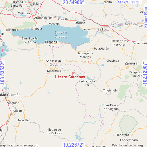
Lázaro Cárdenas GPS coordinates[2]
19° 53' 21.372" North, 102° 49' 55.884" West
| Map corner | latitude | longitude |
|---|---|---|
| Upper-left | 20.54906°, | -103.53532° |
| Center: | 19.88927°, | -102.83219° |
| Lower-right: | 19.22672°, | -102.12907° |
| Map W x H: | 147×147 km | = 91.3×91.3mi |
| max Lat: | 32.7° ⇑45.1% North |
| Lázaro Cárdenas: | 19.88927° |
| min Lat: | ⇓54.9% South 14.53588° |
| min Long | Lázaro Cárden | max Long |
| -117.105° | -102.83219° | -86.73105° |
| W 14.8%⇐ | ⇒85.2% E |
Elevation
Elevation of Lázaro Cárdenas is 1628 m = 5341 ft, and this is 374.3 m = 1228 ft above average elevation for this country.
| Max E: |
3497 m = 11473 ft | 43.8% |
| Lázaro Cárdenas | 1628 m 5341 ft | |
| Avg. | 1253.7 m = 4113 ft | |
Min E: |
-1 m = -3 ft | 56.2% |
See also: Mexico elevation on elevation.city.
Geographical zone
Lázaro Cárdenas is located in North Torrid zone (between Equator and Tropic of Cancer). Distance of this Northern Tropic circle is 394.4 km =245.1 mi to North.| Distance of | km | miles | from Lázaro Cárdenas |
|---|---|---|---|
| North Pole | 7795.6 | 4844 | to North |
| Arctic Circle | 5189.7 | 3224.7 | to North |
| Tropic Cancer | 394.4 | 245.1 | to North |
| Equator | 2211.5 | 1374.2 | to South |


Nearby cities:
15 places around Lázaro Cárdenas: (largest is in red/bold)
• Abadiano (Los Bajos)
12.4 km =7.7 mi,  346°
346°
• Colonia Cuauhtémoc
18.3 km =11.4 mi,  38°
38°
• Cotija de la Paz
16.3 km =10.1 mi,  123°
123°
• El Sabino
16.9 km =10.5 mi,  317°
317°
• Fraccionamiento 18 de Marzo
17.4 km =10.8 mi, 42°
• Fraccionamiento Colinas Universidad
17.5 km =10.9 mi,  34°
34°
• Jiquílpan de Juárez
16.6 km =10.3 mi,  45°
45°
• Los Remedios
18.8 km =11.7 mi,  58°
58°
• Mazamitla
19.9 km =12.4 mi,  278°
278°
• Ojo de Rana
18.8 km =11.7 mi,  340°
340°
• Paso de Piedra
16 km =9.9 mi,  307°
307°
• Quitupan
6 km =3.7 mi, 314°
• San Juanico
17.2 km =10.7 mi,  106°
106°
• San Martín Totolán
19.1 km =11.9 mi, 56°
• Valle de Juárez
12.6 km =7.8 mi,  292°
292°
Sources, notices
• [Note1] Compared only with cities in Mexico existing in our database
• [Src1] Map data: © OpenStreetMap contributors (CC-BY-SA)
• [Src2] Other city data from geonames.org with taken over terms of usage.
• [Src3] Geographical zone / Annual Mean Temperature by Robert A. Rohde @ Wikipedia
