Irapuato geodata
Irapuato (Guanajuato) is a seat of a second-order administrative division; located in Mexico in America/Mexico_City (GMT-6) time zone. With population of 380,941 people, there are 52 cities with bigger population in this country. Compared to other cities in Mexico, 71.4% of cities are located further ↓South; 76.1% of cities are located further →East and 59.6% of cities have lower elevation than Irapuato. Note1


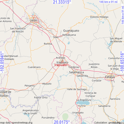
Irapuato GPS coordinates[2]
20° 40' 36.3" North, 101° 21' 22.608" West
| Map corner | latitude | longitude |
|---|---|---|
| Upper-left | 21.33315°, | -102.05941° |
| Center: | 20.67675°, | -101.35628° |
| Lower-right: | 20.0175°, | -100.65316° |
| Map W x H: | 146.3×146.3 km | = 90.9×90.9mi |
| max Lat: | 32.7° ⇑28.6% North |
| Irapuato: | 20.67675° |
| min Lat: | ⇓71.4% South 14.53588° |
| min Long | Irapuato | max Long |
| -117.105° | -101.35628° | -86.73105° |
| W 23.9%⇐ | ⇒76.1% E |
Elevation
Elevation of Irapuato is 1720 m = 5643 ft, and this is 466.3 m = 1530 ft above average elevation for this country.
| Max E: |
3497 m = 11473 ft | 40.4% |
| Irapuato | 1720 m 5643 ft | |
| Avg. | 1253.7 m = 4113 ft | |
Min E: |
-1 m = -3 ft | 59.6% |
See also: Irapuato elevation on elevation.city.
Geographical zone
Irapuato is located in North Torrid zone (between Equator and Tropic of Cancer). Distance of this Northern Tropic circle is 306.9 km =190.7 mi to North.| Distance of | km | miles | from Irapuato |
|---|---|---|---|
| North Pole | 7708 | 4789.5 | to North |
| Arctic Circle | 5102.1 | 3170.3 | to North |
| Tropic Cancer | 306.9 | 190.7 | to North |
| Equator | 2299 | 1428.5 | to South |


Nearby cities:
15 places around Irapuato: (largest is in red/bold)
• Arandas
5.6 km =3.5 mi,  341°
341°
• Carrizal Grande
6.2 km =3.9 mi,  57°
57°
• Colonia Vista Alegre
5 km =3.1 mi,  271°
271°
• El Carmen
4.4 km =2.7 mi,  202°
202°
• El Carrizalito
4.5 km =2.8 mi,  47°
47°
• El Copalillo
5.7 km =3.5 mi,  11°
11°
• Fraccionamiento Campestre las Flores
5.6 km =3.5 mi, 10°
• Fraccionamiento las Liebres
5.2 km =3.2 mi,  231°
231°
• La Candelaria (El Rodete)
4.4 km =2.7 mi,  235°
235°
• La Zahúrda
4.5 km =2.8 mi,  191°
191°
• Las Huertas Tercera Sección
4.7 km =2.9 mi, 235°
• San Francisco de la Charca (El Nido)
3.7 km =2.3 mi, 266°
• San José de Bernalejo (El Guayabo)
6.2 km =3.9 mi, 228°
• San José de Jorge López
4.6 km =2.9 mi,  260°
260°
• Villas de Irapuato
5.2 km =3.2 mi,  282°
282°
Sources, notices
• [Note1] Compared only with cities in Mexico existing in our database
• [Src1] Map data: © OpenStreetMap contributors (CC-BY-SA)
• [Src2] Other city data from geonames.org with taken over terms of usage.
• [Src3] Geographical zone / Annual Mean Temperature by Robert A. Rohde @ Wikipedia
